Featured image for this comprehensive guide about what is dji rtk?
Image source: www-cdn.djiits.com
In a world increasingly reliant on data and precision, the ability to capture accurate spatial information has become paramount. From surveying vast construction sites to optimizing crop yields in agriculture, reliable geospatial data underpins critical decisions across countless industries. For years, traditional methods of mapping and surveying have been time-consuming, labor-intensive, and often limited by the inherent inaccuracies of standard GPS technology.
Enter the era of drones – revolutionary tools that have transformed how we perceive and interact with our environment. However, while early drones offered unprecedented aerial perspectives, achieving the centimeter-level accuracy required for professional applications remained a challenge. This is where DJI RTK steps in, bridging the gap between convenience and professional-grade precision. If you’ve heard the term “RTK” floating around in drone circles and wondered about its significance, particularly within the DJI ecosystem, you’re in the right place.
This comprehensive guide will demystify what is DJI RTK, exploring its underlying technology, its profound benefits, practical applications, and how it empowers professionals to achieve unparalleled accuracy in their drone operations. Prepare to dive deep into the world of real-time kinematic corrections and discover how DJI has made high-precision drone mapping more accessible than ever before.
Quick Answers to Common Questions
What exactly is DJI RTK?
DJI RTK refers to DJI’s implementation of Real-Time Kinematic satellite navigation technology for their drones, providing incredibly precise positioning data. It’s essentially an upgrade to standard GPS, giving your drone centimeter-level accuracy.
Why is DJI RTK important for drone operations?
If you’re doing professional mapping, surveying, or precise inspection, DJI RTK ensures your drone knows its exact location in 3D space with unmatched precision. This leads to much more accurate data capture and highly reliable results for your projects.
How accurate can DJI RTK really get?
DJI RTK systems can achieve impressive horizontal accuracy of up to 1 cm + 1 ppm and vertical accuracy of 1.5 cm + 1 ppm. This means your drone’s location data is extremely precise, making it ideal for critical industrial applications.
Which DJI drones use DJI RTK technology?
You’ll find DJI RTK integrated into many of their professional and enterprise-grade drones, such as the Matrice 300 RTK, Matrice 350 RTK, and the Phantom 4 RTK. These models are built to leverage its high-precision capabilities right out of the box.
Is using DJI RTK difficult to set up or operate?
Despite its advanced nature, DJI designs its RTK systems to be quite user-friendly with straightforward setup processes. You’ll generally operate it through the intuitive DJI Pilot app, making high-precision data collection more accessible than ever.
📋 Table of Contents
- Demystifying RTK: The Foundation of High-Precision GPS
- Diving Deep into What is DJI RTK?
- The Unmatched Benefits of DJI RTK for Professional Applications
- Setting Up and Operating a DJI RTK System: Practical Insights
- DJI RTK vs. PPK: Making the Right Choice
- Future Trends and Innovations in DJI RTK Technology
- Conclusion: The Future is Precise with DJI RTK
Demystifying RTK: The Foundation of High-Precision GPS
To truly understand what is DJI RTK, we first need to grasp the fundamental principles of RTK technology itself. At its core, RTK (Real-Time Kinematic) is an advanced GPS correction technology designed to overcome the limitations of standard Global Navigation Satellite Systems (GNSS), which includes GPS, GLONASS, Galileo, and BeiDou.
Understanding GNSS and GPS Limitations
Your smartphone’s GPS is great for navigation, but it typically offers accuracy within a few meters (3-10 meters, or 10-30 feet) at best. This level of accuracy is insufficient for professional applications like surveying, construction site progress tracking, or precision agriculture, where errors of even a few centimeters can lead to significant problems. Several factors contribute to these inaccuracies:
| Key Aspect | Description | Typical Performance/Benefit |
|---|---|---|
| **What is RTK?** | Real-Time Kinematic (RTK) is a satellite navigation technique used to enhance the precision of position data derived from satellite-based positioning systems (e.g., GPS, GLONASS). | Corrects errors in real-time, achieving high positional accuracy. |
| **DJI Integration** | DJI incorporates RTK modules into professional drones (e.g., Matrice 300 RTK, Phantom 4 RTK) paired with a D-RTK 2 Mobile Station or network RTK services. | Seamless integration for out-of-the-box high-precision capabilities. |
| **Accuracy Improvement** | Unlike standard GPS (meters of error), RTK uses real-time correction data from a base station to resolve ambiguity in satellite signals. | Horizontal: 1 cm + 1 ppm; Vertical: 1.5 cm + 1 ppm (typically). |
| **Operational Principle** | A stationary base station collects satellite data and transmits correction information to the drone, compensating for atmospheric and other errors. | Enables precise georeferencing without, or with significantly fewer, Ground Control Points (GCPs). |
| **Primary Applications** | Essential for tasks demanding high precision, such as surveying, 3D mapping, construction progress monitoring, inspection, and precision agriculture. | Reduces operational time and costs, improves data reliability and efficiency for critical projects. |
- Atmospheric Delays: Signals slow down as they pass through the ionosphere and troposphere.
- Orbital Errors: Minor inaccuracies in the reported positions of the satellites.
- Satellite Clock Errors: Slight discrepancies in the atomic clocks on satellites.
- Multipath Error: Signals bouncing off buildings, terrain, or other obstacles before reaching the receiver.
- Receiver Noise: Internal noise within the GPS receiver itself.
These errors accumulate, preventing standard GPS from delivering the pinpoint precision required by many industries.
How RTK Technology Works
RTK technology fundamentally changes this by introducing a “base station” that acts as a reference point. Imagine trying to measure the exact distance to a moving object (your drone) while you’re standing on unstable ground (standard GPS). RTK is like having a perfectly still, calibrated measuring tape (the base station) to correct your measurements in real-time.
Here’s a simplified breakdown of the RTK process:
- The Base Station: A stationary GNSS receiver (the base station) is set up at a known, precisely surveyed location. This base station continuously receives satellite signals.
- Calculating Errors: Because the base station knows its exact position, it can calculate the difference between its measured position (based on satellite signals) and its actual, known position. This difference represents the real-time GNSS errors in the area.
- Transmitting Corrections: The base station then transmits these calculated correction data to a “rover” receiver. In the context of drone mapping, the drone itself acts as the rover.
- Real-Time Correction: The drone’s RTK module receives these correction signals in real-time and applies them to its own GNSS measurements. This process effectively removes most of the common GPS errors, allowing the drone to determine its position with exceptional accuracy – typically within 1-2 centimeters horizontally and 2-3 centimeters vertically.
This constant stream of correction data enables the drone to pinpoint its location with incredible precision while in flight, leading to highly accurate georeferenced images and data.
Diving Deep into What is DJI RTK?
Now that we understand the basics of RTK, let’s focus on how DJI, the world leader in civilian drones, has integrated and optimized this powerful technology. When we talk about what is DJI RTK?, we’re referring to DJI’s proprietary implementation of RTK, designed to work seamlessly with their professional-grade drone platforms, significantly enhancing their mapping and surveying capabilities.
DJI’s RTK Ecosystem
DJI has made high-precision drone technology accessible to a wider range of professionals by integrating RTK modules directly into some of their most popular and robust drone platforms. Key components of a typical DJI RTK system include:
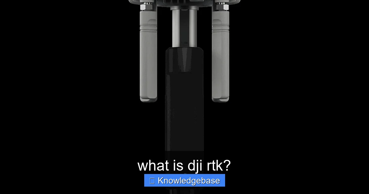
- RTK-Enabled Drones: DJI offers several drones with integrated RTK modules, such as the Matrice 300 RTK, Phantom 4 RTK, and Mavic 3 Enterprise RTK. These drones have high-precision GNSS receivers that can process RTK correction data.
- DJI D-RTK 2 Mobile Station: This is DJI’s dedicated high-precision GNSS receiver that acts as a portable base station. It’s designed for simple setup and operation, providing centimeter-level positioning data to the drone, either through its built-in radio or via cellular (4G) network.
- NTRIP Network RTK: In areas with cellular coverage, DJI RTK drones can connect to a Network RTK (NTRIP) service provider. These services typically have a network of permanent base stations, and your drone receives correction data over the internet, eliminating the need for a physical DJI D-RTK 2 Mobile Station on site. This requires a subscription to an NTRIP service.
- Post-Processed Kinematic (PPK) Support: Many DJI RTK drones also record raw satellite observation data. This allows for Post-Processed Kinematic (PPK) workflows, where corrections are applied after the flight using data from a base station. This offers a robust backup or alternative, especially in areas with intermittent real-time correction signal.
How DJI RTK Ensures Precision
The integration of the RTK module directly into the drone’s flight system means that each image captured is tagged with highly accurate geospatial coordinates at the moment of capture. This “direct georeferencing” is crucial. Instead of relying on the drone’s less accurate standard GPS for image geotagging, DJI RTK drones leverage the real-time corrected position, ensuring that the center of each photo is precisely located in space.
This real-time correction is processed by the drone’s onboard flight controller, continuously adjusting its position information to reflect the most accurate data. For professionals, this means significantly less time spent on the ground establishing Ground Control Points (GCPs), which are traditionally used to correct drone mapping errors in post-processing. With DJI RTK, the need for GCPs can be drastically reduced, often to just a few for verification, or eliminated entirely in some applications.
The Unmatched Benefits of DJI RTK for Professional Applications
The adoption of DJI RTK technology isn’t just about buzzwords; it delivers tangible, transformative benefits for professionals across a multitude of industries. Its impact on data quality, operational efficiency, and overall project cost-effectiveness is profound.
Superior Accuracy and Reliability
The most immediate and significant benefit of DJI RTK is the dramatic improvement in spatial accuracy. While consumer drones might offer positional accuracy in meters, DJI RTK systems routinely achieve:
- Horizontal Accuracy: Typically 1-2 centimeters (0.4-0.8 inches)
- Vertical Accuracy: Typically 2-3 centimeters (0.8-1.2 inches)
This level of centimeter-level accuracy is critical for applications that demand precise measurements, such as:
- Surveying and Mapping: Generating highly accurate orthomosaics, digital terrain models (DTMs), and 3D models for land surveys, urban planning, and infrastructure development.
- Construction: Monitoring site progress, calculating earthwork volumes, verifying compliance with blueprints, and managing material stockpiles with unmatched precision.
- Agriculture: Creating precise prescription maps for variable rate application of fertilizers and pesticides, optimizing irrigation, and monitoring crop health down to individual plant rows.
The enhanced reliability also means less data re-collection due to positional errors, leading to more trustworthy results that stand up to professional scrutiny.
Enhanced Efficiency and Workflow Streamlining
Beyond accuracy, DJI RTK benefits workflow efficiency in several key ways:
- Reduced Need for Ground Control Points (GCPs): Historically, drone mapping required deploying numerous GCPs across a survey area, manually measuring their precise coordinates, and then using them in post-processing to correct drone data. This process is time-consuming, labor-intensive, and can be hazardous in challenging terrain. DJI RTK significantly reduces or even eliminates the need for GCPs, slashing field time by as much as 75-90% in some cases, according to industry reports.
- Faster Data Acquisition: With less time spent on GCP setup, flight missions can commence quicker, and larger areas can be covered in less time.
- Simplified Post-Processing: Because images are already accurately georeferenced, the post-processing workflow becomes much simpler and faster. Software can process data with greater confidence, leading to quicker delivery of final maps and models.
- Cost-Effectiveness: While the initial investment in an RTK drone may be higher, the long-term savings in labor, time, and project efficiency often make DJI RTK systems a highly cost-effective solution for professionals. The ability to complete more projects with fewer resources directly translates to increased profitability.
Versatile Applications Across Industries
The precision offered by DJI RTK makes it indispensable across a wide array of professional fields:
- Land Surveying: Boundary delineation, topographical mapping, volumetric calculations for earthworks.
- Construction: Progress monitoring, as-built surveys, facade inspections, safety compliance checks.
- Mining & Quarrying: Stockpile volume measurement, pit design verification, reclamation monitoring.
- Agriculture: Crop health analysis, yield estimation, precision spraying and fertilizing, drainage planning.
- Infrastructure Inspection: Bridges, roads, railways, and power lines can be inspected with precise location data for maintenance and planning.
- Environmental Monitoring: Coastal erosion studies, reforestation progress, wildlife habitat mapping.
- Public Safety: Accident reconstruction, crime scene mapping, search and rescue operations where precise location data is critical.
In essence, any application requiring highly accurate spatial data can gain a significant advantage by utilizing DJI RTK drones.
Setting Up and Operating a DJI RTK System: Practical Insights
While the technology behind DJI RTK is sophisticated, DJI has engineered its systems for user-friendliness, making setup and operation relatively straightforward for professionals. Understanding the practical aspects is key to maximizing its potential.
Choosing Your RTK Correction Source
The first critical decision involves how your drone will receive its real-time kinematic corrections:
- DJI D-RTK 2 Mobile Station: This is the most common method, especially in remote areas without reliable cellular coverage. You set up the D-RTK 2 at a known point (or allow it to establish its own accurate position over time), and it broadcasts corrections directly to your drone via its radio link. Ensure the base station has a clear view of the sky and is free from obstructions for optimal performance.
- NTRIP Network RTK: If you’re operating in an area with good cellular signal and have a subscription to an NTRIP service (provided by various commercial or governmental organizations), your DJI RTK drone can connect to this network via a 4G dongle or Wi-Fi hotspot. The drone sends its approximate location to the NTRIP server, which then sends back highly localized correction data. This eliminates the need to transport and set up a physical base station.
- Custom Base Station: While less common for the typical DJI user, experienced surveyors might integrate their own third-party GNSS base stations to provide RTK corrections to DJI drones, often through specific software or network configurations.
Pre-Flight Planning and Best Practices
Effective planning is crucial for successful DJI RTK setup and mission execution:
- Site Assessment: Before deploying, assess the site for potential signal interference (e.g., tall buildings, dense foliage, power lines), which can affect both drone communication and GNSS signal reception.
- Base Station Placement (if using D-RTK 2): Position the DJI D-RTK 2 Mobile Station in an open area with an unobstructed view of the sky, away from large metallic objects or electronic interference. If surveying a large area, ensure the drone will remain within the D-RTK 2’s operational range.
- Flight Path Planning: Utilize DJI’s flight planning software, such as DJI Pilot 2 (for newer drones like Matrice 300 RTK, Mavic 3 Enterprise RTK) or DJI GS Pro (for Phantom 4 RTK), to create precise flight paths. Configure parameters like altitude, overlap (typically 75-80% frontal and side overlap for mapping), and camera angle.
- RTK Status Check: Always verify that your drone has achieved an “RTK FIX” status before takeoff. This indicates it is successfully receiving and applying corrections. DJI Pilot 2 provides clear visual indicators for this.
- Battery Management: Plan your missions to account for battery life, including extra batteries for multi-flight operations.
- Weather Conditions: Avoid flying in high winds, heavy rain, or extreme temperatures, which can impact drone stability and RTK signal integrity.
Data Processing and Output
Once your flight is complete, the accurately geotagged images are ready for processing. Software like DJI Terra, Pix4D, Agisoft Metashape, or other photogrammetry packages can then stitch these images into high-resolution orthomosaics, 3D models, or dense point clouds. The beauty of DJI RTK is that these outputs will inherently possess the centimeter-level accuracy captured during the flight, minimizing or eliminating the need for further georeferencing adjustments.
DJI RTK vs. PPK: Making the Right Choice
While DJI RTK is known for its real-time corrections, it’s also important to understand its close relative, PPK (Post-Processed Kinematic). Many DJI RTK-enabled drones also offer PPK capabilities, meaning they record raw satellite observation data that can be used for post-processing.
Understanding PPK (Post-Processed Kinematic)
PPK also relies on a base station and a rover, but the correction data is not applied in real-time during the flight. Instead, the drone records its raw GNSS data, and the base station records its own raw data concurrently. After the flight, these two sets of data are combined and processed offline using specialized software to achieve high-precision results.
Key Differences and When to Choose Each
Here’s a breakdown of the primary differences between DJI RTK vs PPK and considerations for choosing between them:
- Real-time vs. Post-processing:
- DJI RTK: Provides real-time corrections. The drone knows its precise location *during* the flight. This is great for immediate feedback and applications where real-time accuracy is beneficial.
- PPK: Corrections are applied *after* the flight. The drone may fly with standard GPS accuracy, and precise geotags are added in post-processing.
- Connectivity Requirement:
- DJI RTK: Requires a continuous, stable connection to the correction source (D-RTK 2 or NTRIP) throughout the flight. If the signal is lost, the drone reverts to standard GPS, and accuracy may suffer for that segment.
- PPK: Does not require a continuous connection during flight. As long as the drone and base station both record raw data, corrections can be applied later. This makes PPK more robust in areas with intermittent signal or challenging environments.
- Workflow Complexity:
- DJI RTK: Generally simpler post-processing, as images are already accurately geotagged. “What you fly is what you get.”
- PPK: Requires an additional step of post-processing the raw GNSS data to apply corrections and update image geotags.
- Error Robustness:
- DJI RTK: A momentary loss of RTK fix can lead to small, localized inaccuracies in the dataset.
- PPK: Can be more resilient to signal interruptions or poor satellite visibility during flight, as long as sufficient data is collected for post-processing. Errors can sometimes be smoothed out across the entire flight path.
When to Choose DJI RTK:
- When you need immediate, accurate results on site.
- For applications where a continuous, stable correction signal is assured.
- When minimizing post-processing time is a high priority.
- For real-time missions like precise autonomous navigation or specific inspection tasks.
When to Choose PPK (or use as a backup with DJI RTK):
- In challenging environments where RTK signal drops are likely (e.g., urban canyons, dense forests).
- When redundancy is critical, and you want a fallback even if RTK connection is lost.
- If you prefer to have more control over the processing parameters in post-production.
Many DJI RTK drones offer the best of both worlds, enabling RTK for real-time benefits while simultaneously recording raw data for PPK as a safety net. This ensures maximum data integrity and flexibility.
Future Trends and Innovations in DJI RTK Technology
The field of drone technology is constantly evolving, and DJI RTK technology is no exception. DJI continues to push the boundaries, integrating RTK with other cutting-edge technologies to enhance performance, expand capabilities, and make precision mapping even more accessible.
Key Areas of Innovation
- Enhanced Sensor Fusion: Future DJI RTK systems will likely see even tighter integration of RTK data with other onboard sensors (IMUs, visual sensors, LiDAR). This sensor fusion will lead to even more robust and accurate positioning, especially in environments where GNSS signals might be weak or obstructed.
- AI and Machine Learning Integration: Artificial intelligence and machine learning could be used to optimize RTK performance, predict signal degradation, and even help in autonomous path planning to maintain RTK fix in complex environments. AI-powered analytics will also extract more valuable insights from the precise data collected by RTK drones.
- Increased GNSS Constellation Support: As more GNSS constellations become fully operational (like Galileo and BeiDou), DJI RTK modules will continue to support a broader range of satellites, leading to improved accuracy, availability, and reliability, especially in challenging urban or mountainous areas.
- Miniaturization and Affordability: As RTK components become smaller and more cost-effective, we can expect to see DJI RTK technology integrated into an even wider range of drones, potentially making centimeter-level precision accessible to a broader consumer base or specialized niches.
- 5G Connectivity: The rollout of 5G networks will significantly enhance the performance and reliability of NTRIP-based RTK systems, offering faster, more stable connections for correction data, particularly in enterprise applications.
- Cloud-Based Processing and Real-time Deliverables: With improved connectivity and processing power, future DJI RTK workflows might involve more real-time cloud-based processing, enabling instant delivery of high-accuracy maps and models as the drone flies.
DJI’s commitment to innovation means that professionals can expect even more powerful, efficient, and intelligent RTK solutions in the years to come, further cementing the drone’s role as an indispensable tool for precision data acquisition.
Comparing Accuracy: Standard GPS vs. DJI RTK
To put the benefits of DJI RTK into perspective, consider the typical accuracy differences between a standard drone GPS system and a DJI RTK system:
| Metric | Standard Drone GPS | DJI RTK System |
|---|---|---|
| Horizontal Accuracy | ~1-3 meters (3-10 feet) | ~1-2 centimeters (0.4-0.8 inches) |
| Vertical Accuracy | ~3-5 meters (10-16 feet) | ~2-3 centimeters (0.8-1.2 inches) |
| GCP Requirement for Mapping | High (many needed for precision) | Low to None (few for verification, or none) |
| Mission Time Efficiency | Lower (significant GCP setup time) | Higher (minimal to no GCP setup) |
| Post-Processing Complexity | Higher (requires GCP adjustments) | Lower (direct georeferencing) |
This table clearly illustrates the leap in performance and efficiency offered by DJI RTK systems, making them an invaluable asset for professional applications.
Conclusion: The Future is Precise with DJI RTK
In a rapidly evolving technological landscape, the ability to capture accurate, reliable, and actionable data is what sets leading professionals apart. Our journey through what is DJI RTK has revealed that this isn’t merely an incremental upgrade; it’s a fundamental shift in how drone-based data acquisition is performed, delivering a level of precision once reserved for highly specialized and expensive equipment.
DJI RTK technology empowers industries from construction and surveying to agriculture and infrastructure management to achieve centimeter-level accuracy with unprecedented efficiency. By minimizing the need for extensive ground control points, streamlining workflows, and ensuring the integrity of geospatial data, DJI has effectively democratized high-precision drone mapping. This translates into significant cost savings, faster project completion, and ultimately, more informed decision-making across the board.
As DJI continues to innovate, we can anticipate even more sophisticated and integrated RTK solutions, further enhancing the capabilities of drones and solidifying their role as indispensable tools for precision professionals. If your operations demand the highest level of spatial accuracy and efficiency, exploring DJI RTK drones is not just an option, but a strategic imperative. Embrace the future of precision mapping and unlock the full potential of your drone fleet with DJI RTK.
🎥 Related Video: DJI Enterprise – Introducing Matrice 350 RTK
📺 DJI
DJI #DJIEnterprise #Matrice350RTK Introducing DJI Matrice 350 RTK, a fully powered enterprise drone that’s powered to forge …
Frequently Asked Questions
What is DJI RTK?
DJI RTK (Real-Time Kinematic) refers to the advanced positioning technology integrated into select DJI drones. It utilizes a network of ground stations or a base station to provide real-time correction data, significantly enhancing the precision of the drone’s location data compared to standard GPS.
How does DJI RTK improve accuracy?
DJI RTK systems work by receiving continuous correction signals from a ground reference station or a network RTK service. These corrections account for atmospheric and satellite clock errors, enabling the drone to pinpoint its location with centimeter-level accuracy in real time. This drastically reduces positional errors during data capture.
What are the main benefits of using DJI RTK drones?
The primary benefits of DJI RTK drones include achieving centimeter-level positional accuracy for mapping, surveying, and 3D modeling. This precision minimizes or eliminates the need for numerous ground control points (GCPs), streamlines workflows, and ensures highly reliable data collection, leading to significant time and cost savings on projects.
Which DJI drones are equipped with RTK technology?
DJI integrates RTK technology into its professional and enterprise-grade drones designed for high-precision applications. Notable examples include the DJI Matrice 300 RTK, Matrice 350 RTK, Mavic 3 Enterprise RTK series, and the Phantom 4 RTK, all engineered for demanding industrial tasks.
Do I need a separate base station for DJI RTK to work?
For optimal performance, DJI RTK typically requires a dedicated base station, such as the DJI D-RTK 2 Mobile Station, to provide accurate correction data. Alternatively, some DJI RTK-enabled drones can connect to a network RTK service (NTRIP) via an internet connection, which eliminates the need for a physical base station on site.
What kind of accuracy can I expect from DJI RTK?
When properly configured and operated, DJI RTK systems can achieve horizontal accuracy down to 1 cm + 1 ppm and vertical accuracy down to 1.5 cm + 1 ppm. This level of precision makes it ideal for professional applications where highly accurate geospatial data is critical.


