Drones aren’t just for hobbyists anymore; they’ve become indispensable tools across various industries, and architecture is certainly one of them. For professionals looking to enhance their project visualization, site surveying, and construction monitoring, finding the best drone for architects can truly revolutionize their workflow. Imagine capturing stunning aerial perspectives of a potential site, generating accurate 3D models with photogrammetry software, or monitoring construction progress with unparalleled detail – all from a bird’s-eye view.
Choosing the right drone can feel a bit daunting with so many options out there. You’ll need something reliable, easy to operate, and equipped with a camera that delivers high-quality imagery crucial for architectural tasks. This guide is designed to help you navigate the options and identify the best drone for architects that will fit your specific needs, whether you’re a seasoned professional or just starting to integrate drone technology into your practice.
Let’s dive into some top contenders and essential considerations!
Why Architects Need Drones: A Game Changer
Before we look at specific models, let’s briefly touch on why drones are becoming a staple in an architect’s toolkit:
- Detailed Site Analysis: Drones offer comprehensive aerial views of project sites, helping architects understand topography, existing structures, and surrounding context better than ground-level inspections ever could. This aids in better initial design and planning.
- 3D Modeling & Mapping: Equipped with high-resolution cameras, drones can capture vast amounts of data used to create precise 3D models and detailed maps through photogrammetry software. This is invaluable for accurate measurements, volume calculations, and detailed project visualization.
- Construction Progress Monitoring: Regular drone flights allow architects to document construction phases, identify potential issues early, and ensure the project aligns with design specifications. It’s a fantastic way to keep stakeholders informed.
- Marketing & Client Presentations: High-quality aerial photos and videos can elevate project proposals and presentations, offering clients a dynamic and immersive view of future developments.
- Accessibility & Safety: Drones can access hard-to-reach areas safely, reducing the need for dangerous manual inspections of tall structures or hazardous sites.
Now, let’s explore some of the drones that could be the perfect fit for your architectural endeavors.
Product Reviews
Given the product list provided, we will focus on the drones relevant to architectural work. Unfortunately, some listed items (“Asian Times”, “Football Fans: Under Their Skin”, “Ukraine: War and Food”) are not drone products and therefore cannot be reviewed in this context. We will proceed with the actual drone models available.
Drones with Camera for Adults 4k HD FPV, Foldable Remote…

This foldable drone is an excellent entry-level option for architects looking to dip their toes into aerial site assessment without breaking the bank. What makes it stand out is its combination of a 4K wide-angle camera and ease of use, packed into a highly portable design. For basic site surveys, capturing progress photos, or getting a quick lay of the land, this drone offers significant value. Its trajectory flight feature, allowing you to draw a path on your screen, is particularly useful for pre-planning specific flight routes to capture consistent data points for project visualization.
-
Key Features:
- Foldable arms for easy portability.
- Dual camera switch for versatile shooting.
- Altitude hold mode for stable flight.
- WiFi FPV for real-time transmission to phone.
- 4K wide-angle camera for high-definition pictures and video.
- Trajectory Flight for autonomous flight along a designated path.
- Headless Mode for simplified control.
- 2.4GHz Technology for anti-interference.
- 3-level flight speed for varied control.
- High strength and resistant engineering plastics fuselage.
-
Pros:
- Highly portable and easy to carry, ideal for site visits.
- Affordable entry point for drone technology in architecture.
- 4K camera provides decent imagery for basic inspections and progress photos.
- Trajectory Flight simplifies route planning for consistent data capture.
- Headless Mode makes it user-friendly for beginners.
-
Cons:
- May lack advanced features like GPS positioning and obstacle avoidance found in professional drones.
- Flight time might be limited compared to higher-end models.
- Image stabilization might not be on par with professional architectural surveying needs.
-
User Impressions: Users often praise this drone for its compact size and straightforward operation, making it a great choice for hobbyists and those new to drones. While it might not replace high-end surveying equipment, many find it surprisingly capable for casual aerial photography and video, perfect for initial site overviews or sharing quick visual updates.
- See it on Amazon here
DJI Mavic Air Fly More Combo Arctic 4k Drone Electronics,…

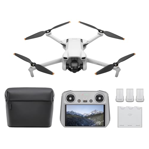
The DJI Mavic Air Fly More Combo is a fantastic option for architects seeking a balance of portability, advanced features, and high-quality imaging. DJI is a renowned name in drone technology, and the Mavic Air truly shines with its 32.0MP sphere panoramas feature, allowing you to create stunning, crystal-clear 360-degree views of a site or structure. This is incredibly useful for comprehensive site documentation and immersive client presentations. Its compact, foldable design ensures it’s easy to transport to any construction site or meeting, making it a powerful tool for serious aerial mapping and project visualization.
-
Key Features:
- 32.0MP sphere panoramas (stitches 25 photos in 8 seconds for 360 views).
- Lightweight and compact foldable design.
- 4K video recording.
- High-resolution still photography.
- Manufactured in China (standard for DJI).
- 1 optical Zoom (clarity over digital zoom).
- “Fly More Combo” usually includes extra batteries, a charging hub, and a carrying bag for extended flight time and convenience.
-
Pros:
- Exceptional image quality and the unique sphere panorama feature are excellent for detailed site capture and client presentations.
- Very portable and easy to deploy on-site.
- DJI’s reputation for stable flight and reliable technology provides peace of mind.
- Optical zoom offers superior detail retention compared to digital zoom.
- “Fly More Combo” ensures longer operational periods, crucial for comprehensive surveys.
-
Cons:
- Higher price point than entry-level drones.
- While compact, it might not have the extreme wind resistance or payload capacity of much larger industrial drones.
- Learning all its advanced features might take some time for new users.
-
User Impressions: Architects and serious hobbyists consistently laud the Mavic Air for its superb camera capabilities and impressive flight performance in a small package. Users particularly appreciate the intelligent flight modes and the quality of the 4K video and panorama shots, finding it incredibly useful for everything from real estate to detailed construction site documentation. It’s often cited as a top choice for those who need professional results without the bulk of larger drone systems.
- See it on Amazon here
Key Considerations When Choosing the Best Drone for Architects
Beyond specific models, here’s what architects should keep in mind when selecting their ideal drone:
- Camera Quality: This is paramount. Look for 4K video recording and high-megapixel stills (12MP minimum, 20MP+ preferred) for crisp, detailed imagery essential for site analysis and photogrammetry.
- Flight Time: Longer flight times (20-30 minutes per battery is good) mean fewer interruptions and more efficient data collection, especially for larger sites. “Fly More” combos with extra batteries are often a smart investment.
- GPS Stability & Obstacle Avoidance: These features provide safer, more precise flights, which are critical when navigating complex construction sites or flying near existing structures. Reliable GPS ensures accurate positioning for mapping.
- Portability: Architects are often on the go. A compact, foldable drone that’s easy to transport will be used more frequently.
- Ease of Use & Intelligent Flight Modes: While professionals need advanced features, an intuitive interface and intelligent flight modes (like Waypoint, ActiveTrack, or Trajectory Flight) can significantly streamline data capture.
- Software Compatibility: Ensure the drone’s output (images/videos) is compatible with your architectural software, CAD programs, or photogrammetry software for 3D modeling and analysis.
- Durability & Wind Resistance: Construction sites can be challenging environments. A drone built with durable materials and good wind resistance will withstand more use.
- Regulatory Compliance: Always be aware of local drone regulations, licensing requirements, and airspace restrictions before flying.
Frequently Asked Questions (FAQ)
Q1: What kind of camera resolution do I need for architectural drone photography?
A1: For architectural work, aim for at least a 12-megapixel camera for still images and 4K (Ultra HD) resolution for video. Higher megapixels (20MP+) and optical zoom are even better for capturing fine details on buildings and for precise photogrammetry, which is crucial for 3D modeling.
Q2: Is GPS crucial for an architect’s drone?
A2: Absolutely. GPS is vital for stable flight, accurate positioning, and precisely repeatable flight paths. This accuracy is essential for aerial mapping, surveying, and creating consistent datasets over time for construction monitoring. It also enhances safety and ease of use.
Q3: How important is flight time for architectural applications?
A3: Flight time is very important. Longer flight times (typically 20-30 minutes per battery) mean you can cover larger areas or perform more extensive inspections without needing to land and swap batteries frequently. For architects conducting detailed site surveys or monitoring progress, maximizing flight efficiency is key.
Q4: Can drones help with 3D modeling for architects?
A4: Yes, drones are excellent for 3D modeling. By capturing hundreds of overlapping high-resolution images from different angles (a technique called photogrammetry), specialized software can stitch these photos together to create highly accurate 3D models and point clouds of sites and structures. This data is invaluable for design, analysis, and as-built documentation.
Q5: What is “obstacle avoidance” and do I need it?
A5: Obstacle avoidance refers to sensors on a drone that detect objects in its flight path and automatically reroute or stop the drone to prevent collisions. For architects flying in complex environments like construction sites, near trees, or existing buildings, obstacle avoidance is a highly recommended safety feature that provides significant peace of mind and protects your investment.
Q6: Are foldable drones good for architects?
A6: Yes, foldable drones are often ideal for architects. Their compact size and portability make them easy to carry to various job sites, store in a vehicle, or even take on flights. This convenience means you’re more likely to use the drone frequently, integrating it seamlessly into your workflow.
Q7: Do I need a special license to fly a drone for architectural work?
A7: In many regions, flying a drone for commercial purposes (which architectural work qualifies as) requires a specific license or certification. For example, in the US, you need an FAA Part 107 certificate. Always check your local aviation authority’s regulations to ensure you are flying legally and safely.
Q8: How can drones help with construction monitoring?
A8: Drones can provide regular, detailed aerial imagery of construction sites. Architects can use this data to track progress, verify compliance with design plans, identify potential issues early, manage resources, and communicate updates to clients and stakeholders more effectively than traditional ground inspections.
Conclusion
Finding the best drone for architects means finding a tool that seamlessly integrates into your design, planning, and monitoring processes. Whether you prioritize portability, advanced mapping capabilities, or simply a reliable way to get an aerial perspective, there’s a drone out there for you.
Models like the DJI Mavic Air offer a fantastic blend of professional features in a highly portable package, while more budget-friendly options can still provide immense value for basic site intelligence. By considering camera quality, flight stability, battery life, and ease of use, you’ll be well on your way to making an informed decision that elevates your architectural projects to new heights. Happy flying!


