Drones have completely transformed the construction landscape, making site mapping, progress monitoring, and volumetric calculations faster and more efficient than ever before. If you’re leveraging a drone for construction mapping, you know that accuracy is paramount. While the drone itself plays a big role, achieving truly pinpoint precision often comes down to one unsung hero: Ground Control Points (GCPs).
GCPs are essential for ensuring your aerial data aligns perfectly with real-world coordinates, leading to highly accurate 2D maps and 3D models. They act as critical reference points that tie your drone’s aerial imagery to a precise ground-based coordinate system. Whether you’re tracking earthwork, monitoring progress, or conducting final surveys, using the right GCPs can elevate your data from “good” to “exceptionally accurate.”
But with so many options out there, how do you pick the right ones? We’ve rounded up five excellent Ground Control Points that are perfect for construction drone mapping, helping you get the most out of your aerial surveying efforts. Let’s dive in!
1. Sky High Bull’s-Eye Drone Ground Control Point GCP (Numbered)

When precision and easy identification are key, the Sky High Bull’s-Eye GCP with numbered targets is a real game-changer. These ground markers are designed to simplify your workflow, allowing you to quickly correlate aerial images with specific ground coordinates. They’re built tough for the field and provide excellent visibility, ensuring your drone captures the data you need for highly accurate construction mapping projects.
Key Features:
– Numbered targets (0-9) for easy identification and correlation with coordinates.
– White & black color scheme for optimal visibility, even in bright conditions.
– Four corner eyelets to securely fix the GCP to the ground, especially in windy environments.
– Lightweight and durable waterproof material built for field use.
– 24″ x 24″ checkerboard pattern ideal for detection at altitudes up to 400 feet.
Pros:
– Numbered for streamlined data processing with mapping software like Pix4D and DroneDeploy.
– High contrast color scheme ensures clear image capture.
– Robust design resists wear and tear, even in challenging weather.
– Easy to transport and set up thanks to its lightweight nature.
Cons:
– Only goes up to number 9, which might require purchasing multiple sets for very large projects.
– The fixed size might not be ideal for all specific project requirements.
User Impressions:
Users frequently praise the clear numbering system and the high visibility of these GCPs. Many appreciate the durability and the secure eyelets, which prevent the markers from shifting during mapping missions. It’s often cited as a reliable choice for achieving excellent photogrammetry results in construction and surveying.
2. Sky High Bull’s-Eye Drone Ground Control Point GCP (Center Cutout)

This version of the Sky High Bull’s-Eye GCP stands out with its novel center cutout design, specifically engineered to streamline your mapping workflow when you’re working with pre-established survey markers. Simply align your drone’s camera with the passthrough, and you’re set for accurate data capture and precise alignment with existing control points. It’s all about making your construction mapping more efficient and precise.
Key Features:
– Novel center cutout design for seamless alignment with existing survey markers.
– Four corner anchor points for secure and consistent ground placement.
– Numbered markers (0-9) for easy identification and referencing during missions.
– Crafted from high-quality, durable materials for long-lasting performance.
– Foldable and lightweight for easy portability and storage.
Pros:
– Unique cutout design saves time by integrating with existing survey points.
– Excellent durability ensures a long lifespan in demanding field conditions.
– Numbered system keeps your data organized and reduces field confusion.
– Highly portable, making it easy to carry to various job sites.
Cons:
– The cutout design might not be necessary for all projects, potentially adding complexity if not utilized.
– Numbered only 0-9, so larger projects may need multiple packs.
User Impressions:
Surveyors love the innovative center cutout feature, noting how it simplifies the alignment process with established benchmarks. The portability and robust build quality are also frequently highlighted, making it a favorite for professionals who need reliable GCPs they can trust project after project.
3. RothBucher Ground Control Target 350×350 mm with Center Cross
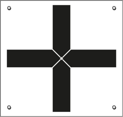
The RothBucher Ground Control Target is a robust and highly visible option designed for professionals who demand extreme accuracy. Its prominent central cross provides an unambiguous reference point, crucial for high-precision land surveying and construction drone mapping. Built to withstand tough outdoor conditions, this target is a reliable workhorse for any serious aerial surveying project.
Key Features:
– High-precision design with a clearly marked central cross for accurate positioning.
– Generous 350×350 mm dimensions (approx. 13.8″ x 13.8″) for excellent visibility.
– Durable build from robust materials to resist wear in demanding field conditions.
– Weather-resistant, maintaining clarity and performance even in harsh outdoor environments.
– Multi-use application: perfect for construction, photogrammetry, and geodetic work.
Pros:
– Central cross ensures unambiguous and precise targeting.
– Excellent visibility from various altitudes and distances.
– Exceptional durability for long-term field use.
– Reliable performance in diverse weather conditions.
Cons:
– Smaller than the 24″x24″ options, which might require lower flight altitudes for optimal detection.
– Lacks specific numbering, requiring manual labeling or alternative tracking methods.
User Impressions:
Customers highly value the RothBucher target for its straightforward, high-precision design. Its robust construction and ability to endure harsh weather are often praised, making it a go-to for professionals who need a dependable, no-frills GCP for critical construction mapping tasks.
4. Sky High Bull’s-Eye (24”x24”) Drone Ground Control Point (Black/White)

This Sky High Bull’s-Eye GCP offers enhanced field coordination and optimal visibility for your construction drone mapping missions. Its classic black and white color scheme is specifically chosen to ensure excellent target detection, even under bright sunlight or challenging lighting conditions. Measuring a generous 24″x24″, it provides an ideal size for comprehensive and accurate surveying results.
Key Features:
– Enhanced field coordination with numbered survey markers for easy identification.
– Optimal black/white color scheme for excellent target visibility in various conditions.
– Four corner eyelets for secure ground placement, ensuring stability during data capture.
– Lightweight yet durable material for long-lasting performance in demanding environments.
– Ideal 24″ x 24″ size for versatile drone mapping missions, compatible with Pix4D and DroneDeploy.
Pros:
– High-contrast black/white scheme offers superior visibility for drone cameras.
– Numbered points streamline data processing and identification.
– Built tough to withstand rugged construction site conditions.
– Large size ensures detection even at higher altitudes (up to 400ft).
Cons:
– While durable, repeated harsh handling might eventually lead to wear.
– The numbering system is limited (0-9), potentially requiring multiple sets for large-scale projects.
User Impressions:
Users appreciate the balanced blend of visibility, durability, and ease of use this GCP offers. The numbered system is a big plus for organization, and the robust construction means it stands up well to regular field use. It’s often recommended for its consistent performance across various construction mapping projects.
5. Sky High Bull’s-Eye Drone Ground Control Point GCP (Black/Grey)

Similar to its black/white counterpart, this Sky High Bull’s-Eye GCP differentiates itself with a black/grey color scheme, which some find offers subtle advantages in specific lighting or terrain conditions. It still provides the core benefits of excellent visibility, secure placement, and robust durability, making it another fantastic choice for achieving top-tier accuracy in your construction drone mapping projects.
Key Features:
– Enhanced field coordination with numbered survey markers for effortless identification.
– Optimal black/grey color scheme for excellent target visibility in bright and challenging lighting.
– Four corner eyelets for secure ground placement, ensuring stable data capture.
– Lightweight yet durable material for long-lasting performance.
– Ideal 24″ x 24″ size for versatile drone mapping missions, compatible with Pix4D and DroneDeploy.
Pros:
– Alternative black/grey color scheme might perform better in certain environments.
– Numbered points aid in precise coordinate tracking and streamline fieldwork.
– Robust construction ensures resistance to wear and tear on busy construction sites.
– Generous size provides ample surface area for accurate data collection.
Cons:
– The black/grey contrast might not be as universally optimal as black/white in all conditions.
– Like other numbered sets, it’s limited to 0-9 targets per pack.
User Impressions:
Customers using this version often highlight its consistent performance and the benefits of the numbered system for managing complex projects. While the color scheme is a subtle difference from the black/white, users report it performs reliably, providing the necessary precision for professional construction site management and surveying.
Why Ground Control Points Are Crucial for Drone Construction Mapping
You might have a state-of-the-art drone, but without proper Ground Control Points, your mapping data could be significantly less accurate than it needs to be. Here’s why GCPs are non-negotiable for anyone serious about the best drone for construction mapping results:
- Pinpoint Accuracy: Drones rely on GPS, which has inherent inaccuracies (often several feet). GCPs, surveyed with high-precision GPS or total stations, provide absolute accuracy, correcting any drift or errors in the drone’s position data. This is vital for critical measurements, volume calculations, and precise site progress monitoring.
- Georeferencing: GCPs ensure your drone-generated maps and 3D models are accurately placed in a real-world coordinate system. This is crucial for integrating your aerial data with CAD, GIS, and BIM platforms.
- Consistency Over Time: When conducting repeat surveys to monitor construction progress, GCPs ensure that each dataset is aligned precisely with previous ones, allowing for accurate comparison and change detection.
- Error Reduction: By providing fixed reference points, GCPs minimize photogrammetric processing errors, leading to cleaner point clouds, more accurate digital elevation models, and higher quality orthomosaics.
In essence, while the drone captures the raw imagery, GCPs are what transform that imagery into actionable, survey-grade data.
FAQ Section
Q1: What exactly are Ground Control Points (GCPs) in drone mapping?
A1: Ground Control Points (GCPs) are clearly visible markers placed on the ground within the area being mapped by a drone. Their precise geographical coordinates (latitude, longitude, and elevation) are measured using traditional surveying equipment (like RTK GPS or total stations). These known points are then used during photogrammetry processing to georeference the drone’s images, ensuring the final map or 3D model is highly accurate and aligned with real-world coordinates.
Q2: Why are GCPs so important for construction drone mapping?
A2: For construction mapping, accuracy is everything. Drones typically use consumer-grade GPS, which can have an error margin of several feet. GCPs, measured with survey-grade equipment, provide fixed, highly accurate reference points. They correct these GPS inaccuracies, allowing for precise measurements, volume calculations, accurate progress tracking, and seamless integration of drone data with CAD, GIS, and BIM systems. They are essential for achieving the best drone for construction mapping outcomes.
Q3: Can I do drone construction mapping without GCPs?
A3: Yes, you can technically map without GCPs, especially with RTK/PPK enabled drones. However, the resulting maps will have lower absolute accuracy. While they might be good for visual inspection or relative measurements within the same flight, they won’t be survey-grade accurate. For precise volumetric calculations, legal boundary work, or integration with existing survey data, GCPs are highly recommended, if not essential.
Q4: How many GCPs do I need for a typical construction site?
A4: The number of GCPs depends on the size and complexity of your site, the required accuracy, and the terrain. A general rule of thumb is to have at least 5-10 well-distributed GCPs, with some placed at the corners of your project area and others scattered throughout. For larger or more irregular sites, you might need more. It’s always a good idea to consult best practices for photogrammetry and your specific software’s recommendations.
Q5: How do I use GCPs with my drone mapping software?
A5: The process generally involves:
1. Placement: Strategically place your GCPs across the site before the drone flight.
2. Measurement: Use survey-grade GPS or a total station to record the precise X, Y, Z coordinates of each GCP.
3. Drone Flight: Fly your drone to capture aerial imagery of the site, ensuring all GCPs are visible in multiple images.
4. Processing: In your photogrammetry software (e.g., Pix4D, DroneDeploy), upload the drone images and the measured GCP coordinates.
5. Tagging: Manually or automatically “tag” the location of each GCP in several drone images within the software. The software then uses these tags to refine the geometric model and ensure high accuracy.
Q6: What’s the ideal size and design for a GCP?
A6: Ideal GCPs are typically high-contrast (like black and white or black and grey checkerboard patterns) and large enough to be clearly visible in drone imagery, even from higher altitudes. Sizes around 24″x24″ or 350x350mm are common. Designs often include a central cross or bull’s-eye for precise targeting, and some have numbering for easy identification. Features like corner eyelets for secure ground placement are also very beneficial.
Q7: Can RTK/PPK drones replace the need for GCPs entirely?
A7: RTK (Real-Time Kinematic) and PPK (Post-Processed Kinematic) drones significantly improve the absolute accuracy of the drone’s GPS data, reducing the need for many GCPs. For many applications, an RTK/PPK drone might only require a few “check points” (points with known coordinates not used in processing but for accuracy verification) rather than a full set of GCPs. However, for the highest survey-grade accuracy or in areas with poor satellite signal, a minimal number of GCPs can still be beneficial for redundancy and validation.
Conclusion
When it comes to construction mapping, precision isn’t just a nice-to-have; it’s a necessity. While the drone does the heavy lifting in the sky, Ground Control Points are the silent workhorses on the ground that guarantee your aerial data translates into truly accurate, actionable insights. Investing in high-quality GCPs like the ones reviewed here will significantly enhance your deliverables, streamline your workflow, and ensure you’re getting the absolute best drone for construction mapping results possible from your equipment. So, don’t overlook these crucial tools – they’re key to elevating your drone mapping projects to the next level of accuracy and reliability.


