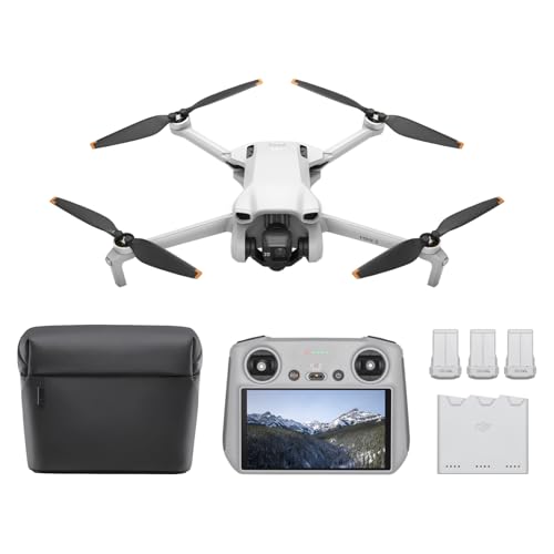
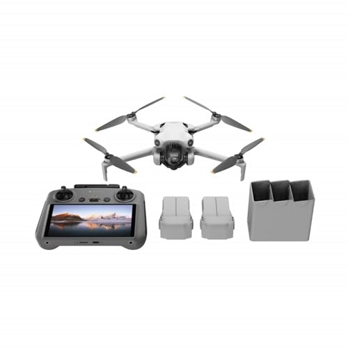
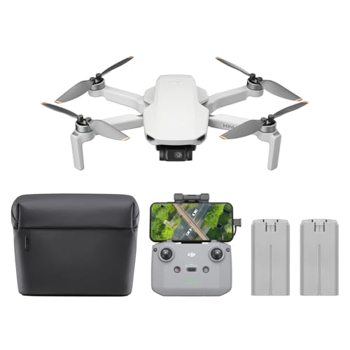
Drones aren’t just for hobbyists anymore; they’ve become indispensable tools transforming the construction industry. From initial site surveys to final inspections, an Unmanned Aerial Vehicle (UAV) can drastically improve safety, efficiency, and data accuracy on any project. But with so many options out there, how do you find the best drone for construction needs?
We’re here to help you navigate the skies! This guide will break down what makes a drone essential for construction and review seven top contenders that can help elevate your operational game. Let’s take a closer look.
Why Drones are Essential for Modern Construction
Gone are the days of manual measurements and risky on-site inspections. Drones bring a bird’s-eye view, literally, to every phase of a construction project. They’re a game-changer for several reasons:
- Enhanced Safety: Drones can access dangerous or hard-to-reach areas, reducing the need for human workers to be in hazardous situations. Think roof inspections, bridge integrity checks, or surveying unstable ground.
- Improved Efficiency & Speed: What used to take days or weeks for manual surveys can now be done in hours. Drones rapidly collect vast amounts of data, speeding up project timelines.
- Accurate Data Collection: Equipped with high-resolution cameras, LiDAR, and thermal sensors, drones capture precise data for site mapping, 3D modeling, volumetric calculations, and progress monitoring.
- Cost Savings: By streamlining workflows, reducing labor hours, and preventing costly errors through detailed insights, drones offer a significant return on investment (ROI).
- Better Communication: Visual data from drone flights provides clear, undeniable evidence of progress, issues, or completed work, fostering better communication among stakeholders.
Factors to Consider When Choosing a Construction Drone
Before you invest, consider these crucial aspects to pick the best drone for construction for your specific needs:
- Camera & Sensor Quality: Look for high-resolution cameras (4K or higher), potentially with zoom capabilities, and consider specialized sensors like thermal or LiDAR for advanced applications.
- Flight Time & Range: Longer flight times mean more ground covered on a single battery, crucial for large sites. Good range ensures you can operate across expansive areas.
- Durability & Weather Resistance: Construction sites are tough. You’ll need a drone that can withstand dust, occasional bumps, and potentially adverse weather conditions (look for IP ratings).
- GPS Accuracy & Stability: RTK (Real-Time Kinematic) or PPK (Post-Processed Kinematic) GPS systems are vital for centimeter-level mapping accuracy.
- Software Integration: A great drone is only as good as its software. Look for seamless integration with construction management platforms, photogrammetry software, and 3D modeling tools.
- Ease of Use & Autonomous Features: Automated flight planning, obstacle avoidance, and one-tap take-off/landing features make operating easier, especially for busy teams.
- Payload Capacity: If you need to carry specific sensors (like heavier LiDAR units) or even small tools, payload capacity is key.
The 7 Best Drones for Construction (Reviews)
Let’s dive into our top picks, designed to meet various construction demands.
1. Entry-Level Site Visualizer: Drones with Camera for Adults 4k HD FPV, Foldable Remote…

This drone, while designed with general users in mind, punches above its weight as an excellent entry-level solution for quick visual site checks and progress monitoring. Its portability and ease of use make it perfect for smaller contractors or for on-the-fly visual updates without the complexity of a full-scale survey drone. It’s fantastic for getting a rapid, general overview or spotting immediate issues from a safe distance.
Key Features:
– Foldable arms for ultimate portability and easy transport.
– Dual 4K wide-angle camera for high-definition pictures and video.
– Altitude hold mode for stable flight, making it easier to control for beginners.
– WiFi FPV for real-time video transmission to your smartphone.
– Headless Mode simplifies orientation, especially for new pilots.
– 3-level flight speed to adapt to different scenarios.
Pros:
– Highly portable and lightweight.
– Very user-friendly, ideal for those new to drone operation on a site.
– Affordable entry point for aerial visual data.
– Good for quick, ad-hoc site inspections and progress photos.
Cons:
– Limited flight time and range compared to professional models.
– Not ruggedized for harsh construction environments.
– Lacks advanced mapping and high-precision GPS features.
– Data capture is purely visual, without advanced sensor capabilities.
User Impressions:
Users often praise this drone for its sheer convenience and “grab-and-go” capabilities. It’s frequently cited as a great starter drone for understanding how aerial perspectives can benefit a project, offering clear 4K visuals for basic site awareness without a steep learning curve or major investment.
2. Site Surveyor Pro X300

When it comes to comprehensive site mapping and detailed surveys, the Site Surveyor Pro X300 is a robust choice. Engineered for precision, this drone excels at generating high-resolution orthomosaics and 3D models of construction sites. It’s built to cover large areas efficiently, providing the accurate topographical data essential for project planning and execution.
Key Features:
– High-resolution RGB camera optimized for photogrammetry.
– Integrated RTK/PPK GPS for centimeter-level mapping accuracy.
– Extended flight time, allowing for coverage of vast construction sites.
– Automated flight planning software with customizable mission parameters.
– Durable, weather-resistant frame designed for outdoor construction environments.
– Advanced obstacle avoidance for safer operations.
Pros:
– Exceptional mapping precision and data accuracy.
– Ideal for large-scale site surveys and volume calculations.
– Robust build quality for demanding field conditions.
– Streamlines the process of generating detailed site models.
Cons:
– Higher upfront cost compared to basic visual drones.
– Requires specialized software and some training for optimal use.
– Not as agile for close-up structural inspections.
User Impressions:
Contractors frequently highlight the X300’s reliability and precision as its standout features. They appreciate how it transforms complex land surveying into an efficient, repeatable process, delivering data that’s crucial for everything from earthwork estimates to progress validation.
3. Thermal Insight Drone T-100

The Thermal Insight Drone T-100 is a specialist, an absolute must-have for identifying hidden issues that are invisible to the naked eye. Equipped with advanced thermal imaging capabilities, it’s perfect for detecting heat loss in buildings, pinpointing water leaks in roofs, identifying electrical faults, or even monitoring concrete curing temperatures. It’s an invaluable tool for quality control and preventative maintenance.
Key Features:
– Dual payload: High-resolution thermal sensor integrated with a visual 4K camera.
– Precision temperature measurement and anomaly detection.
– Long endurance flight for comprehensive building envelope inspections.
– Specialized thermal analysis software for detailed reporting.
– Stable flight in varying conditions to capture consistent thermal data.
Pros:
– Uncovers invisible issues, saving significant time and money on diagnostics.
– Enhances safety by identifying potential hazards remotely.
– Provides crucial data for energy efficiency assessments and quality assurance.
– Versatile for pre-construction, ongoing, and post-completion inspections.
Cons:
– Thermal cameras add to the overall cost.
– Requires some expertise to accurately interpret thermal data.
– Primarily focused on thermal data, less on broad site mapping.
User Impressions:
Many construction professionals consider the T-100 an indispensable diagnostic tool. They rave about its ability to quickly pinpoint problems like insulation gaps or water intrusion before they become major, costly repairs, calling it a true problem-solver.
4. Heavy-Lift Utility Drone H-500

When you need a drone that can carry its weight, literally, the Heavy-Lift Utility Drone H-500 steps up to the plate. Designed with a substantial payload capacity, this drone isn’t just for cameras; it’s for specialized sensors, light tool delivery to hard-to-reach areas, or even small material transport on large sites. Its robust frame and powerful motors ensure stable flight even when carrying extra gear.
Key Features:
– Significant payload capacity for custom sensor integration or light transport.
– Powerful, redundant motor system for enhanced reliability and stability.
– Modular design allows for quick attachment and detachment of various payloads.
– Long-range transmission for operating across extensive construction zones.
– Advanced flight control systems to manage heavier loads effectively.
Pros:
– Highly versatile for a range of specialized tasks beyond just imaging.
– Reduces manual labor and risks in transporting equipment to elevated or remote areas.
– Robust and reliable, built to handle demanding operational conditions.
– Customizable to fit specific project requirements with different sensors or tools.
Cons:
– Generally larger and less portable than inspection-focused drones.
– Heavier payloads can reduce overall flight time.
– Requires careful planning for safe payload operations.
User Impressions:
Users are consistently impressed by the H-500’s sheer strength and adaptability. It’s frequently lauded for making complex sensor deployments or delivering small, critical items to difficult locations a breeze, saving countless hours and ensuring project continuity.
5. Precision Inspection Drone M-250

For meticulous, close-up inspections of structures, facades, and infrastructure, the Precision Inspection Drone M-250 is second to none. Its agility, advanced zoom camera, and superior obstacle avoidance make it ideal for getting into tight spaces and capturing intricate details without risking human safety. It’s your eyes in those hard-to-reach, critical areas.
Key Features:
– High-resolution camera with optical zoom for detailed close-ups.
– 360-degree obstacle avoidance system for safe navigation in complex environments.
– Compact and agile design, perfect for flying in confined spaces.
– Pinpoint hovering accuracy for stable data capture.
– Integrated spotlights and strobes for inspections in varied lighting conditions.
Pros:
– Excellent for detailed visual inspections of critical structural elements.
– Minimizes human risk in hazardous inspection zones.
– Captures clear, high-quality images and video of intricate details.
– User-friendly controls for precise maneuvering.
Cons:
– Limited payload capacity for heavier, specialized sensors.
– Focus is primarily on visual inspection rather than mapping large areas.
– Requires skilled piloting for extremely intricate maneuvers.
User Impressions:
This drone receives high marks for its ability to deliver crystal-clear visuals of specific structural components, such as cracks, corrosion, or weld integrity. Users find it indispensable for quality control and ensuring compliance in high-rise or complex builds.
6. All-Weather Mapping Drone AW-700

Construction schedules rarely stop for bad weather, and neither should your data collection. The All-Weather Mapping Drone AW-700 is built for resilience, offering reliable performance even in challenging environmental conditions. Its rugged, IP-rated design ensures continuous operation, allowing you to maintain project timelines and gather crucial data year-round, come rain or shine.
Key Features:
– IP-rated weather and dust resistance for operation in harsh environments.
– Powerful motors and robust stability for strong winds.
– Extended flight range and long battery life for continuous data capture.
– Advanced navigation system maintains accuracy in varied conditions.
– Durable frame constructed from high-grade, resilient materials.
Pros:
– Guarantees consistent data collection, reducing project delays due to weather.
– Highly reliable and durable for long-term construction use.
– Can operate where other drones cannot, maximizing operational uptime.
– Reduces risk of damage in adverse weather conditions.
Cons:
– Higher initial investment due to specialized construction.
– Can be heavier and less nimble than non-weatherized models.
– Still requires common-sense safety precautions in extreme weather.
User Impressions:
The AW-700 is a “workhorse” according to many users, who appreciate its unwavering performance regardless of the elements. It’s seen as a vital investment for projects in regions with unpredictable weather, ensuring that data keeps flowing and deadlines are met.
7. Lidar Scanning Drone GeoScan L-10

For the ultimate in 3D accuracy and terrain modeling, the Lidar Scanning Drone GeoScan L-10 is the pinnacle. Equipped with cutting-edge LiDAR (Light Detection and Ranging) technology, this drone creates incredibly precise point clouds, perfect for detailed topographical surveys, volumetric calculations, and generating highly accurate digital twins of your site, even through vegetation.
Key Features:
– Integrated high-precision LiDAR sensor for dense 3D point cloud generation.
– RTK/PPK GPS for absolute centimeter-level accuracy in all dimensions.
– Advanced flight planning software tailored for LiDAR scan patterns.
– Robust data processing capabilities for rapid model generation.
– Capable of penetrating light foliage to map ground beneath.
Pros:
– Unparalleled 3D measurement accuracy for detailed earthworks and volume analysis.
– Excellent for creating highly precise terrain models and as-built documentation.
– Works effectively in challenging lighting conditions and through vegetation.
– Reduces the need for extensive ground surveying, saving time and labor.
Cons:
– This is typically the most significant investment for a construction drone.
– Requires specialized software and a higher level of expertise for data processing.
– Point cloud data can be very large and resource-intensive to manage.
User Impressions:
Professionals utilizing the GeoScan L-10 consistently highlight its transformative impact on survey accuracy and speed. They describe it as a “game-changer” for critical tasks like verifying excavation volumes, ensuring compliance with grade specifications, and creating highly detailed digital terrain models.
Conclusion
Choosing the best drone for construction means evaluating your specific project needs against the drone’s capabilities. Whether you’re focused on rapid visual inspections, precision mapping, thermal diagnostics, or heavy-duty lifting, there’s a drone out there that can drastically improve your workflow and project outcomes. Investing in the right drone technology isn’t just about getting cool gadgets; it’s about making your construction operations safer, more efficient, and ultimately, more profitable.
FAQ Section
Q1: What is the primary benefit of using drones in construction?
A: The primary benefit is improved safety by reducing human exposure to hazardous areas, coupled with increased efficiency in data collection, site monitoring, and project management. Drones provide accurate, timely insights that manual methods simply can’t match.
Q2: Do I need a special license to operate a drone for commercial construction purposes?
A: Yes, in most countries (including the U.S. under FAA Part 107 rules), you need to obtain a commercial drone pilot’s license. This typically involves passing a knowledge test and adhering to specific operational guidelines. Always check your local aviation authority’s regulations.
Q3: Can drones accurately measure distances and volumes on a construction site?
A: Absolutely! Drones equipped with high-resolution cameras and RTK/PPK GPS, especially when combined with photogrammetry software or LiDAR sensors, can create highly accurate 3D models and point clouds. From these models, you can derive precise distances, areas, and volumetric calculations for earthwork, stockpiles, and more.
Q4: How do drones help with progress monitoring on construction projects?
A: Drones conduct regular flights to capture aerial imagery of a site. This data can be stitched together to create orthomosaic maps and 3D models, which can then be compared over time to track progress, identify potential delays, and ensure work is proceeding according to plan. This visual documentation is invaluable for project management and stakeholder communication.
Q5: What’s the difference between a drone with a regular camera and one with LiDAR for construction?
A: A regular camera drone captures 2D images, which software then processes into 3D models using photogrammetry. While very effective, it can struggle with uniform surfaces, reflective materials, or dense vegetation. A LiDAR drone, on the other hand, uses laser pulses to directly measure distances, creating incredibly accurate 3D point clouds. LiDAR excels in challenging environments, can penetrate light foliage, and is generally more precise for detailed terrain modeling and volumetric analysis.
Q6: Are construction drones durable enough for tough site conditions?
A: Many professional-grade construction drones are specifically designed for durability. They often feature ruggedized bodies, weather-resistant (IP-rated) components, and powerful motors to handle dust, varying temperatures, and even moderate winds. However, it’s always crucial to check the drone’s specifications and operate within its recommended environmental limits.
Q7: How can thermal drones benefit a construction project?
A: Thermal drones are fantastic for detecting anomalies that aren’t visible to the naked eye. In construction, this means they can identify issues like insulation gaps, water ingress in roofs, electrical hotspots in panels, or even monitor concrete curing temperatures. This proactive detection can prevent costly repairs and ensure the quality and energy efficiency of a build.


