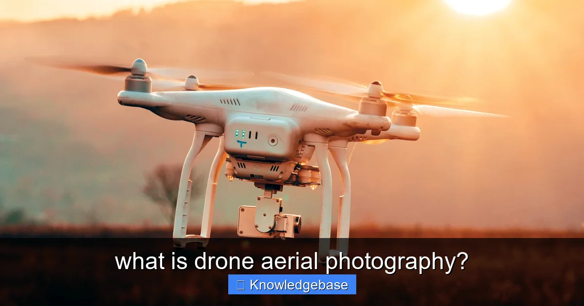
Featured image for this comprehensive guide about what is drone aerial photography?
Image source: english.onlinekhabar.com
The world we perceive from the ground is rich with detail and wonder, but an entirely new dimension of beauty and perspective awaits just above our heads. For centuries, capturing this aerial view was the domain of hot air balloons, cumbersome planes, and expensive helicopters – tools largely inaccessible to the everyday creator or small business. Fast forward to today, and a revolution has taken flight. Enter the era of the drone, transforming the landscape of visual storytelling and bringing breathtaking, elevated views within reach.
Imagine showcasing a sprawling luxury estate, capturing the intricate dance of a wedding from a bird’s-eye view, or monitoring the progress of a massive construction project with unparalleled precision. This incredible capability is at the heart of drone aerial photography. It’s more than just taking pictures from a height; it’s about harnessing advanced technology to unlock artistic, practical, and analytical insights that were once prohibitively expensive or simply impossible. This powerful combination of flight and imaging has carved out a unique and indispensable niche across countless industries.
If you’ve ever been captivated by a sweeping panoramic shot in a film, an impressive overview of a landscape, or a dynamic video tour of a property, chances are you’ve experienced the magic of drone aerial photography. But what exactly is it? How does it work? And why has it become such an indispensable tool? In this comprehensive guide, we’ll delve deep into the world of elevated imaging, exploring its definition, benefits, applications, the gear and skills required, legal considerations, and how you can get started in this exciting field. Prepare to elevate your perspective!
Quick Answers to Common Questions
What exactly is drone aerial photography?
Drone aerial photography is simply the art of capturing stunning photos and videos from above using a camera-equipped drone controlled remotely. It opens up a whole new world of perspectives, offering views that were once only possible with expensive aircraft.
Why choose a drone for aerial photography?
Drones provide unparalleled flexibility and cost-effectiveness, allowing you to get unique, high-resolution shots from various altitudes and angles that traditional ground photography can’t reach. The versatility of drone aerial photography makes it a game-changer for many projects.
What are some common uses for drone aerial photography?
Drone aerial photography is incredibly popular for capturing breathtaking real estate listings, dynamic event coverage, detailed land surveys, construction progress monitoring, and stunning landscape cinematography. Its applications are constantly growing across industries and for creative endeavors.
What kind of images and videos can drone aerial photography capture?
You can capture crisp, high-resolution still photos, wide panoramic views, and incredibly smooth, cinematic video footage, often in 4K or even 8K quality. Drone aerial photography excels at showcasing expansive scenes and details from a unique vantage point.
Is drone aerial photography safe and legal to do?
Yes, when done responsibly, drone aerial photography is generally safe and legal, but it’s crucial to understand and follow local aviation regulations, airspace restrictions, and privacy laws. Always ensure you operate within your visual line of sight and adhere to any licensing requirements.
📋 Table of Contents
- Unveiling the Skies: What Exactly is Drone Aerial Photography?
- The Unrivaled Benefits of Drone Aerial Photography
- Exploring the Diverse Applications of Drone Aerial Photography
- The Essential Gear and Skills for Mastering Drone Aerial Photography
- Navigating the Legal Skies: Regulations and Best Practices
- Future Horizons and How to Get Started in Drone Aerial Photography
- Conclusion
Unveiling the Skies: What Exactly is Drone Aerial Photography?
At its core, drone aerial photography is the art and science of capturing still images and video footage from an elevated perspective using an unmanned aerial vehicle (UAV), commonly known as a drone. Unlike traditional methods that relied on manned aircraft, drones offer unprecedented flexibility, cost-effectiveness, and control, allowing photographers and videographers to access unique angles and produce stunning visual content.
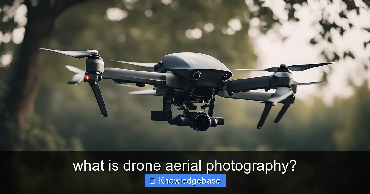
Learn more about what is drone aerial photography? – what is drone aerial photography?
Image source: jeffherman.mystories.cloud
The Core Concept: Merging Drones and Photography
The process involves a drone equipped with a high-resolution camera, controlled remotely by a pilot. The drone’s ability to fly, hover, and maneuver with precision allows the camera to be positioned exactly where needed, capturing images that would be impossible or unsafe to obtain otherwise. Modern drones often come with integrated gimbals – stabilized camera mounts – that ensure smooth, shake-free footage, even in windy conditions. This technological synergy is what makes drone aerial photography so transformative.
| Key Aspect | Description & Benefits | Impact / Comparison (vs. Traditional) |
|---|---|---|
| **Core Concept** | Utilizes unmanned aerial vehicles (UAVs) equipped with cameras to capture high-resolution images or video from elevated perspectives. Offers unique viewpoints inaccessible from the ground. | Democratizes aerial imaging, replacing expensive manned aircraft or cranes for many tasks, making it accessible to a wider audience. |
| **Cost & Accessibility** | Significantly lower operational and equipment costs compared to helicopters or planes. Easier to deploy and operate for short-duration tasks and smaller projects. | Typical cost reduction of 70-90% for aerial shots compared to traditional manned aircraft, opening up aerial photography to small businesses and individuals. |
| **Image Quality & Perspective** | Delivers ultra-high-resolution stills (e.g., 48MP to 100MP+) and cinematic 4K/8K video. Allows for dynamic, smooth camera movements and unique, low-altitude angles. | Captures precise, detailed data from altitudes typically between 50-120 meters, enabling close-up inspections that manned aircraft cannot safely or cost-effectively achieve. |
| **Operational Flexibility** | Can fly in complex environments (e.g., confined spaces, close to structures, variable altitudes) and adjust flight paths instantly. Quick setup and pack-down times. | Missions can often be planned, executed, and data captured within hours, whereas traditional methods might take days or weeks for logistics and permits. |
| **Safety & Efficiency** | Eliminates the need for personnel in dangerous elevated positions for inspections or surveys. Automates repetitive tasks, reducing manual labor. | Significantly reduces human risk exposure to zero for aerial capture, improving workplace safety for tasks like roof, bridge, or power line inspection. |
A Brief History of Aerial Imaging and the Drone Revolution
Aerial photography itself isn’t new. Early attempts date back to the mid-19th century using balloons and even kites. Manned aircraft, like planes and helicopters, took over in the 20th century, becoming vital for military reconnaissance, mapping, and later, commercial applications. However, these methods were expensive, required significant infrastructure, and often posed safety risks. The drone revolution, beginning in the early 21st century, democratized aerial imaging. Originally developed for military purposes, drones quickly found their way into civilian hands, offering hobbyists and professionals alike the power to capture breathtaking views from the sky. This rapid evolution has made drone aerial photography one of the most dynamic and accessible forms of visual media today.
Key Components of Drone Aerial Photography
To successfully engage in drone aerial photography, several key components work in harmony:
- The Drone (UAV): The flying platform itself, ranging from small consumer models to large professional cinematic drones.
- The Camera: Often integrated into the drone, but sometimes interchangeable. Key features include sensor size, megapixels, lens quality, and video resolution (4K, 8K).
- The Gimbal: A motorized stabilizer that keeps the camera level and steady, compensating for drone movement.
- Remote Controller: Used by the pilot to steer the drone and often control camera settings.
- Live Feed/Monitor: A screen (often a smartphone or tablet) that displays real-time footage from the drone’s camera, allowing for precise framing.
- Software: For flight planning, camera control, and crucial post-processing of images and videos.
The Unrivaled Benefits of Drone Aerial Photography
The rise of drone aerial photography isn’t just a fleeting trend; it’s a testament to the profound advantages it offers over traditional imaging methods. These benefits span various industries and creative pursuits, making drones an indispensable tool for visual storytelling and data collection.
Learn more about what is drone aerial photography? – what is drone aerial photography?
Image source: hmsinsurance.com
Unparalleled Perspectives and Creative Angles
Perhaps the most obvious benefit is the ability to capture truly unique and captivating perspectives. Drones can fly higher than a ladder, navigate tight spaces, and hover stably, offering angles that were previously impossible to achieve without significant cost and effort. This freedom allows for dynamic tracking shots, sweeping panoramas, and intimate close-ups from above, unleashing new levels of creativity for photographers and videographers.
Cost-Effectiveness and Efficiency
Compared to hiring a helicopter or an airplane, operating a drone for aerial photography is dramatically more affordable. The cost of equipment, fuel, and pilot fees for manned aircraft is orders of magnitude higher. Drones also offer rapid deployment and quick turnaround times. A drone can be in the air and capturing footage within minutes, significantly reducing operational time and overall project costs. This efficiency makes high-quality aerial content accessible to a broader range of businesses and individuals.
Enhanced Safety in Hazardous Environments
For applications such as inspecting tall structures (bridges, cell towers, wind turbines), surveying dangerous terrains, or monitoring disaster zones, drones provide a critical safety advantage. Instead of sending human personnel into potentially hazardous situations, a drone can capture detailed imagery and data remotely, minimizing risk and ensuring worker safety. This is a game-changer for industries like construction, infrastructure inspection, and emergency services.
Versatility Across Industries
The adaptability of drone aerial photography is staggering. From showcasing properties in real estate to monitoring crop health in agriculture, documenting construction progress, capturing breathtaking wedding videos, or assisting in search and rescue operations, drones have proven their worth across an ever-expanding list of sectors. This versatility is a key driver of their widespread adoption.
High-Quality Imagery and Video
Modern drones are equipped with sophisticated cameras capable of capturing stunningly crisp photos and high-resolution video (often 4K, 5.2K, and even 8K). Coupled with advanced stabilization technology (gimbals) and intelligent flight modes, these cameras produce professional-grade visuals. The dynamic range, color accuracy, and detail captured by top-tier drone cameras rival those of ground-based professional equipment, ensuring that your aerial content is nothing short of spectacular.
Exploring the Diverse Applications of Drone Aerial Photography
The versatility of drone aerial photography has led to its adoption across a multitude of industries, transforming how businesses operate, how events are documented, and how stories are told. Here’s a glimpse into some of its most impactful applications:
Real Estate and Property Marketing
In the competitive real estate market, stunning visuals are paramount. Drone aerial photography provides unparalleled views of properties, showcasing their scale, surroundings, and proximity to amenities. Buyers can see the entire property, its lot lines, landscaping, and even the neighborhood from an elevated perspective. According to MLS statistics, listings with aerial photos can sell up to 68% faster and for a higher price. This application alone has become a cornerstone for real estate agents looking to stand out.
Construction and Infrastructure Monitoring
Drones are revolutionizing construction project management. They can capture regular progress updates, create 3D models of sites, monitor equipment, and conduct safety inspections. This allows project managers to track timelines, identify potential issues early, and ensure compliance with blueprints. For infrastructure, drones are vital for inspecting bridges, power lines, pipelines, and cell towers, significantly reducing the cost and danger associated with traditional inspection methods.
Events, Weddings, and Film Production
For events, drone aerial photography adds a cinematic touch, capturing the grandeur of outdoor weddings, festivals, concerts, and sporting events. Sweeping shots of venues, dynamic crowd footage, and unique perspectives of key moments elevate event videography to new heights. In film and television, drones offer affordable alternatives to crane shots and helicopter passes, enabling independent filmmakers to achieve Hollywood-level production value.
Agriculture and Environmental Surveys
Farmers are utilizing drones for precision agriculture, monitoring crop health, irrigation patterns, and soil conditions. Multispectral cameras on drones can detect issues invisible to the naked eye, allowing for targeted interventions and increased yields. Environmental scientists use drones for wildlife monitoring, forestry management, mapping deforestation, and assessing natural disaster impact, providing crucial data for conservation efforts.
Mapping, Surveying, and 3D Modeling
Drones equipped with advanced GPS and photogrammetry software can create highly accurate maps, topographical data, and 3D models of landscapes, buildings, and construction sites. This is invaluable for urban planning, land development, archaeological surveys, and creating digital twins of physical assets. The speed and accuracy of drone-based surveying far surpass traditional ground-based methods.
News, Media, and Artistic Expression
Journalists use drones to cover news events from a safe distance, providing critical context and compelling visuals. Artists and hobbyists alike leverage drone aerial photography to create breathtaking landscape images, abstract patterns from above, and unique photographic art, pushing the boundaries of visual expression.
The Essential Gear and Skills for Mastering Drone Aerial Photography
To truly excel in drone aerial photography, it’s not enough to simply have a drone. It requires a combination of the right equipment, technical knowledge, and honed piloting and photographic skills. Think of it as a blend of aviation and artistry.
Choosing the Right Drone for Photography
The market for camera drones is vast, but some key considerations will guide your choice:
- Camera Quality: This is paramount. Look for drones with large sensors (1-inch or larger is ideal), high megapixels (20MP+ for stills), and excellent video resolution (4K at 60fps is a good baseline, 5.2K or 8K for professionals). Brands like DJI, Autel, and Skydio lead the pack.
- Stabilization: A high-quality 3-axis gimbal is non-negotiable for smooth footage.
- Flight Time: Longer flight times (25-30+ minutes per battery) mean more time in the air and less downtime for battery swaps.
- Transmission Range: A robust signal ensures reliable control and a clear video feed.
- Intelligent Flight Modes: Features like ActiveTrack, Waypoints, and QuickShots can simplify complex camera movements and help achieve cinematic results.
- Obstacle Avoidance: Sensors that detect and avoid obstacles are crucial for safety, especially for beginners.
For example, a drone like the DJI Mavic 3 Pro or an Autel Evo Max 4N offers a powerful combination of camera quality, flight performance, and intelligent features suitable for professional drone aerial photography.
Crucial Camera Settings and Techniques
Understanding fundamental photography principles is vital for drone aerial photography:
- Shutter Speed: For video, aim for the “180-degree rule” (shutter speed double your frame rate, e.g., 1/60th for 30fps) for natural motion blur. For stills, adjust for sharpness.
- ISO: Keep ISO as low as possible (100-400) to minimize noise, especially in low light.
- Aperture: Control depth of field. Many drone cameras have fixed apertures, while some pro models offer adjustable ones.
- White Balance: Set manually to match lighting conditions for accurate colors.
- Composition: Apply classic rules like the rule of thirds, leading lines, symmetry, and negative space to create visually compelling aerial shots.
- RAW vs. JPEG: Always shoot in RAW for stills to retain maximum image data for post-processing flexibility.
- ND Filters: Neutral Density filters reduce the amount of light entering the lens, allowing you to maintain cinematic shutter speeds in bright conditions. They are indispensable for video.
Post-Processing: Bringing Your Aerial Shots to Life
The raw footage from your drone is just the beginning. Post-processing is where you fine-tune your vision and enhance the quality of your drone aerial photography. Essential software includes:
- Adobe Lightroom/Photoshop: For still image editing – color grading, exposure adjustments, sharpening, noise reduction, and retouching.
- Adobe Premiere Pro/DaVinci Resolve/Final Cut Pro: For video editing – cutting, color correction, stabilization, adding music, and special effects.
Learning these tools will allow you to transform good footage into truly stunning aerial masterpieces.
Pilot Skills and Flight Planning
Beyond the camera, being a proficient drone pilot is crucial. This involves:
- Manual Flight Control: Mastering the joystick controls for smooth, precise movements.
- Flight Planning: Pre-visualizing your shots, checking for obstacles, and planning flight paths to ensure safety and efficiency.
- Weather Awareness: Understanding how wind, rain, and temperature affect drone performance and image quality.
- Battery Management: Knowing your drone’s flight time and planning for battery changes.
- Pre-Flight Checks: A systematic checklist to ensure the drone is safe and ready for flight.
Navigating the Legal Skies: Regulations and Best Practices
While drone aerial photography offers incredible freedom, it’s crucial to understand and adhere to the regulations governing drone operation. Ignoring these rules can lead to significant fines, legal issues, and even dangerous situations. Drone operations are subject to national and local laws, which vary considerably by region.
Understanding Drone Laws and Licensing
Most countries differentiate between recreational and commercial drone operations, with stricter rules for the latter. Here’s a general overview:
- United States (FAA):
- Recreational: Must pass The Recreational UAS Safety Test (TRUST), register drones over 0.55 lbs, and follow community-based guidelines.
- Commercial (Part 107): Requires obtaining a Remote Pilot Certificate (often called the Part 107 license) by passing a knowledge test. This covers operations for hire, even if you’re not paid directly for the flight.
- No-Fly Zones: Prohibited airspace includes near airports, national parks, military bases, and certain critical infrastructure. Always check before you fly using apps like B4UFLY.
- Europe (EASA):
- Harmonized regulations across member states with specific categories (Open, Specific, Certified) depending on risk.
- Pilots generally require online training and an operator registration number.
- The “Open” category covers most recreational and low-risk commercial operations.
It’s vital to research and understand the specific laws in your country and even local municipalities before conducting any drone aerial photography.
Safety First: Pre-Flight Checks and Operational Guidelines
Responsible drone operation is paramount. Always follow these best practices:
- Maintain Visual Line of Sight (VLOS): Always keep your drone within your line of sight. This is a fundamental rule in most regions.
- Respect Airspace Restrictions: Never fly near airports, restricted military zones, or other no-fly areas.
- Check Weather Conditions: Avoid flying in strong winds, rain, fog, or extreme temperatures.
- Pre-Flight Inspection: Before every flight, check your drone’s propellers, battery levels (drone and controller), camera lens, and ensure all firmware is up to date.
- Respect Privacy: Be mindful of individuals’ privacy and avoid flying over private property without permission.
- Avoid Flying Over People: Most regulations prohibit flying directly over people not involved in the operation.
Insurance and Liability Considerations
For anyone conducting drone aerial photography commercially, drone insurance is highly recommended, if not legally required. This protects you from potential liabilities arising from accidents, damage to property, or injury to others. Policies can cover hull damage (to the drone itself) and third-party liability. Understand the scope of your policy and ensure it covers your specific operations.
Future Horizons and How to Get Started in Drone Aerial Photography
The field of drone aerial photography is constantly evolving, with exciting advancements on the horizon. For those looking to enter this dynamic world, now is a fantastic time to begin your journey.
Emerging Technologies and Trends
The future of drone aerial photography promises even more sophisticated capabilities:
- AI and Automation: Smarter drones with enhanced AI will offer more autonomous flight paths, better subject tracking, and automated shot composition.
- Improved Camera Sensors: Expect smaller, lighter cameras with larger sensors, higher resolutions (8K and beyond), and better low-light performance.
- Longer Flight Times and Range: Battery technology continues to improve, leading to extended operational periods and greater reach.
- Integration with 5G: Faster data transmission will enable real-time cloud processing and more robust remote operations.
- Advanced Mapping and 3D Modeling: Drones will play an even more critical role in creating detailed digital twins and immersive virtual environments.
Tips for Aspiring Drone Photographers
Ready to take flight with your camera? Here’s how to get started in drone aerial photography:
- Start with a Beginner-Friendly Drone: You don’t need the most expensive drone to learn. A good entry-level drone will teach you flight controls and camera basics without breaking the bank.
- Master Flight Skills: Practice, practice, practice! Get comfortable with basic maneuvers, hovering, and smooth directional changes before attempting complex shots. Utilize simulators if available.
- Understand Photography Fundamentals: Learn about exposure, composition, lighting, and camera settings. These principles apply whether you’re shooting on the ground or in the air.
- Learn Post-Processing: Editing is half the battle. Invest time in learning photo and video editing software to elevate your raw footage.
- Study the Regulations: Before you fly, know the local laws. If you plan to earn money, get the necessary certifications (e.g., FAA Part 107 in the U.S.).
- Join a Community: Connect with other drone pilots and photographers online or in person. Learning from experienced individuals is invaluable.
- Experiment and Be Creative: Don’t be afraid to try new angles, locations, and techniques. Develop your unique style.
Building a Professional Portfolio
If you’re aiming for a career in drone aerial photography, building a strong portfolio is essential. Focus on showcasing your best work across various applications (real estate, landscapes, events, etc.). Create a dedicated website or use platforms like Instagram and YouTube to display your skills. Network with local businesses and offer your services to gain experience and testimonials. Consistency, quality, and professionalism will be your greatest assets.
Conclusion
Drone aerial photography has undeniably reshaped how we see and interact with the world around us. From providing breathtaking cinematic views to delivering critical data for industry, its impact is profound and ever-expanding. It’s a field that beautifully marries technological innovation with artistic expression, offering unparalleled perspectives that captivate, inform, and inspire. Whether you’re a curious hobbyist, a creative professional, or a business seeking a competitive edge, the sky truly is no longer the limit.
Embracing the world of drone aerial photography means stepping into a realm of endless possibilities. It requires passion, technical skill, a commitment to safety, and an understanding of the evolving legal landscape. But the rewards – the stunning visuals, the unique insights, and the sheer joy of seeing the world from a new vantage point – are immeasurable. So, equip yourself with knowledge, practice your skills, and prepare to elevate your vision. The skies are calling, and with a drone in hand, you’re ready to answer.
🎥 Related Video: 7 EASY TIPS for BETTER DRONE PHOTOGRAPHY
📺 Mark McGee Photos
In this video, I share my 7 top tips and techniques on how to take better aerial photography with your drone, what camera settings …
Frequently Asked Questions
What exactly is drone aerial photography?
Drone aerial photography involves capturing still images or videos from an elevated perspective using a camera mounted on an unmanned aerial vehicle (UAV), commonly known as a drone. This innovative method provides unique viewpoints that were once only accessible via helicopters or airplanes, offering dynamic and breathtaking shots.
What are the main benefits of using drone aerial photography?
The primary benefits of drone aerial photography include access to unique perspectives, cost-effectiveness compared to traditional aerial methods, and the ability to capture high-quality, stable footage from various altitudes and angles. Drones can also reach difficult or dangerous locations, providing unparalleled visual data for many applications.
What are common uses for drone aerial photography?
Drone aerial photography is widely used across various industries for real estate marketing, construction progress monitoring, event coverage, and cinematic film production. It’s also invaluable for inspecting infrastructure, agricultural analysis, and creating stunning visual content for businesses and personal projects.
What equipment is typically needed for professional drone aerial photography?
Essential equipment for drone aerial photography includes a high-quality drone equipped with an advanced camera and gimbal system, a remote controller, and several spare batteries for extended flight times. Additionally, ND filters for the camera lens, a reliable SD card, and post-processing software are crucial for professional results.
How does drone aerial photography capture such stable and high-quality images?
Modern camera drones achieve stable and high-quality images primarily through sophisticated gimbal systems. These motorized gimbals actively stabilize the camera, counteracting any drone movements caused by wind or flight maneuvers, which results in smooth, professional-looking video and sharp, steady photographs.
Are there any regulations or rules for conducting drone aerial photography?
Yes, drone aerial photography is subject to various regulations, which can differ significantly by country and local jurisdiction. These typically include rules regarding flight zones (e.g., no-fly zones near airports), altitude limits, pilot licensing or registration requirements, and privacy concerns. Always check local aviation authority guidelines before flying.


