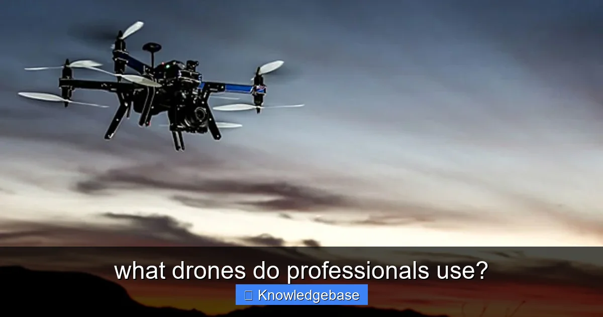
Featured image for this comprehensive guide about what drones do professionals use?
Image source: ichef.bbci.co.uk
Ever gazed at breathtaking aerial footage, wondered how intricate industrial inspections are performed from above, or how vast agricultural fields are meticulously monitored? The answer, more often than not, lies in the sky, piloted by sophisticated drones. But these aren't your typical consumer gadgets. When it comes to high stakes, precision, and reliability, professionals turn to a specialized class of unmanned aerial vehicles (UAVs).
The world of professional drones is a diverse and rapidly evolving landscape, far beyond the realm of hobby flying. From Hollywood film sets capturing cinematic masterpieces to construction sites performing volumetric measurements, and from public safety units responding to emergencies to environmental scientists tracking wildlife, what drones do professionals use? The answer isn't a single model or brand, but rather a curated selection of advanced tools tailored for specific, demanding tasks. These aerial workhorses are designed for superior performance, robust safety features, and seamless integration into complex workflows.
This comprehensive guide will take you on a deep dive into the professional drone ecosystem. We'll explore the critical features that distinguish enterprise-grade UAVs, highlight the leading brands and their flagship models, and categorize them by their most common professional applications. Whether you're an aspiring drone pilot looking to break into the commercial space, a business owner considering integrating drone technology, or simply curious about the cutting edge of aerial innovation, understanding what drones do professionals use is the first step towards unlocking their immense potential.
Quick Answers to Common Questions
What drones do professionals use for everyday work?
Many professionals often turn to reliable and versatile platforms like the DJI Mavic 3 Enterprise series or Autel EVO II Enterprise. These models strike a great balance between portability and advanced features, making them perfect for inspections, mapping, and general aerial data collection.
Are the drones professionals use vastly different from what consumers buy?
Absolutely! While some prosumer drones are powerful, professional-grade equipment often boasts specialized modular payloads, enhanced flight stability, RTK/PPK for pinpoint accuracy, and much more durable builds designed for demanding tasks.
What brands of drones do professionals use most often?
DJI leads a significant portion of the professional drone market with its robust Enterprise lineup. However, Autel Robotics is also a strong contender, offering excellent alternatives for various industrial applications, alongside other specialized manufacturers.
Do what drones do professionals use cost a lot more than hobby models?
Typically, yes, they do. The advanced technology, precision instruments, and rugged construction found in professional drones command a significantly higher price, often ranging from several thousand to tens of thousands of dollars.
What drones do professionals use for specialized tasks like surveying or public safety?
For high-precision surveying, models with RTK/PPK systems like the DJI Matrice 350 RTK or Autel EVO II RTK are go-to choices. Public safety often relies on robust platforms capable of carrying thermal cameras and spotlights, such as the DJI Mavic 3 Thermal or Matrice 30 series.
📋 Table of Contents
- The Core Criteria: What Defines a Professional Drone?
- Top Brands Dominating the Professional Drone Market
- Drones for Cinematography and Photography
- Drones for Surveying, Mapping, and Construction
- Drones for Inspection, Public Safety, and Agriculture
- Emerging Trends and Future of Professional Drones
- Summary of Professional Drone Categories and Applications
- Conclusion: The Diverse Landscape of Professional Drone Use
The Core Criteria: What Defines a Professional Drone?
Before diving into specific models, it’s crucial to understand the fundamental characteristics that elevate a drone from a hobbyist toy to a professional-grade tool. Professionals aren't just looking for flight; they're looking for reliable, repeatable, and precise data acquisition and performance. Here are the non-negotiable criteria:
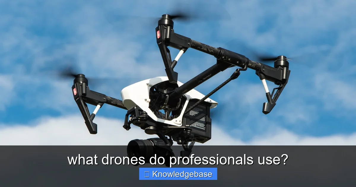
Learn more about what drones do professionals use? - what drones do professionals use?
Image source: esl-tree.com
1. Superior Camera and Sensor Technology
- High-Resolution Imaging: For photography, cinematography, and detailed inspections, 4K, 5.2K, or even 8K cameras with large sensors (e.g., Micro Four Thirds, 1-inch CMOS, full-frame) are standard.
- Advanced Optics: Interchangeable lenses, optical zoom, and low-light performance are critical for versatility and quality.
- Specialized Payloads: Thermal cameras (radiometric for accurate temperature readings), multispectral and hyperspectral sensors (for agriculture, environmental monitoring), LiDAR (for precise 3D mapping), and powerful zoom cameras are commonplace for specific applications.
2. Enhanced Flight Performance and Reliability
- Extended Flight Time: Longer battery life (25-50+ minutes) is essential for covering large areas or extended operations.
- Precise Positioning (RTK/PPK): Real-Time Kinematic (RTK) and Post-Processed Kinematic (PPK) systems provide centimeter-level accuracy for mapping, surveying, and precise data collection, significantly reducing the need for ground control points.
- Robust Stability and Wind Resistance: Professionals often operate in challenging environments, requiring drones that can maintain stable flight in higher winds.
- Redundancy: Dual IMUs, compasses, and GPS modules enhance reliability and safety in critical missions.
3. Advanced Safety and Intelligent Features
- Obstacle Avoidance: Multi-directional sensing systems prevent collisions, crucial for complex industrial environments or dense urban areas.
- Return-to-Home (RTH) and Failsafe Protocols: Automated landing procedures in case of low battery, signal loss, or GPS failure.
- Geofencing: Limits flight to predefined areas, preventing accidental incursions into restricted airspace.
- Intelligent Flight Modes: Waypoint navigation, terrain following, automated mission planning, and object tracking streamline complex operations.
4. Durability and Portability
- Rugged Construction: Professional drones are built to withstand rigorous use, often featuring industrial-grade materials.
- Modular Design: Swappable payloads, batteries, and even arms allow for quick field maintenance and adaptability.
- Portability: While some are large, many are designed to be easily transported and deployed, often folding into compact forms.
5. Comprehensive Software and Ecosystem Integration
- Mission Planning Software: Tools for pre-flight route planning, defining waypoints, and setting camera parameters.
- Data Processing Software: Compatibility with leading photogrammetry, LiDAR processing, and geospatial software (e.g., Pix4D, Agisoft Metashape, ArcGIS).
- Fleet Management: For organizations operating multiple drones, software for managing aircraft, pilots, and maintenance schedules is vital.
- SDK Support: Software Development Kits allow for custom application development and integration with existing enterprise systems.
These features collectively ensure that professional drones are not just flying cameras, but integrated, intelligent tools capable of delivering precise, actionable data across various industries.
| Drone Model | Primary Professional Use Cases | Key Professional Advantage |
|---|---|---|
| DJI Mavic 3 Enterprise Series | High-precision mapping, infrastructure inspection, surveying, emergency response. | Compact, high-resolution camera (20MP 4/3 CMOS), optional RTK for centimeter-level accuracy, up to 45 min flight time. |
| DJI Matrice 350 RTK | Heavy industrial inspection, public safety (SAR, fire), large-scale surveying, power line inspection. | Robust, heavy payload capacity, multi-sensor support (thermal, zoom, LiDAR), IP55 rating, up to 55 min flight. |
| Autel EVO Max 4T | Public safety, search & rescue, industrial inspection, security monitoring. | Advanced omnidirectional obstacle avoidance, strong anti-interference, integrated thermal/zoom cameras, compact foldable design. |
| Skydio X2E | Autonomous asset inspection, public safety (situational awareness), construction progress monitoring. | Industry-leading autonomous flight and obstacle avoidance (Skydio Autonomy Engine), GPS-denied operation, secure platform. |
| senseFly eBee X | Large-area mapping (agriculture, forestry, mining), surveying, environmental monitoring. | Fixed-wing for long endurance (up to 90 min flight), covers vast areas efficiently, wide range of professional sensors (RGB, multispectral, thermal). |
Top Brands Dominating the Professional Drone Market
When asking what drones do professionals use?, certain brand names consistently rise to the top. While the market is increasingly competitive, a few key players have established themselves as industry leaders, offering robust ecosystems and specialized solutions.
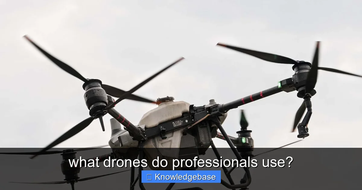
Learn more about what drones do professionals use? - what drones do professionals use?
Image source: nuwayag.com
DJI: The Undisputed Market Leader
No discussion about professional drones is complete without DJI. The Chinese drone giant holds an overwhelming market share in both consumer and commercial segments. Their enterprise line offers an extensive range of UAVs tailored for virtually every professional application. DJI's strength lies in its integrated hardware-software solutions, reliability, and continuous innovation.
- DJI Inspire Series: The Inspire 3 is a flagship for high-end cinema and professional cinematography, featuring a full-frame camera, interchangeable lenses, and an advanced FPV camera.
- DJI Matrice Series (M30, M300 RTK, M350 RTK): These are industrial workhorses, highly customizable with multiple payload options (thermal, zoom, LiDAR, spotlight, loudspeaker), extended flight times, and robust weather resistance. Ideal for inspection, public safety, surveying, and infrastructure monitoring.
- DJI Mavic 3 Enterprise Series (M3E, M3T, M3M): A compact yet powerful solution, offering RTK precision, powerful zoom cameras (M3E), thermal imaging (M3T), and multispectral sensors (M3M) in a highly portable form factor. Popular for surveying, inspection, and agriculture for smaller operations.
- DJI Phantom 4 RTK: A go-to for precise mapping and surveying, known for its integrated RTK module and high-resolution camera.
- DJI Agras Series: Specialized large agricultural drones for spraying and spreading.
Autel Robotics: A Strong Contender
Autel Robotics has emerged as a significant challenger, particularly appealing to professionals seeking alternatives with competitive features. Their EVO II Enterprise series offers impressive specifications and a modular design.
- Autel EVO II Enterprise Series (EVO II Pro RTK, EVO II Dual 640T RTK): Known for their long flight times, high-resolution cameras (6K for Pro), and thermal imaging capabilities (640T). The RTK module provides centimeter-level positioning, making them suitable for mapping, inspection, and public safety.
Parrot: Niche Solutions with a Focus on Security and Data
Parrot, a French company, has carved out a niche with a strong emphasis on data security, particularly appealing to government and defense sectors. Their ANAFI series offers compact, robust solutions.
- Parrot ANAFI USA: Built for professional use, especially for public safety and defense, with encrypted data links, FLIR thermal imaging, and a powerful zoom camera.
Skydio: Autonomy and AI at the Forefront
Skydio, an American company, stands out for its advanced autonomous flight capabilities. Their drones excel at obstacle avoidance and self-piloting, making them ideal for complex inspections in challenging environments.
- Skydio X2: Designed for enterprise, public safety, and defense, it features industry-leading AI-powered obstacle avoidance and autonomous navigation for hands-free inspection and situational awareness.
Specialized & Industrial Manufacturers
Beyond these, various manufacturers produce highly specialized drones for specific industrial applications. Companies like Wingtra (WingtraOne fixed-wing VTOL for surveying), Delair (fixed-wing for long-range mapping), and senseFly (eBee series fixed-wing for surveying) offer high-end solutions for very specific use cases.
The choice of brand and model ultimately depends on the specific professional task, budget, and desired level of integration and support.
Drones for Cinematography and Photography
The visual arts industry has been profoundly transformed by drone technology. For capturing stunning aerial footage, intricate timelapses, or high-resolution stills, professionals demand cameras with exceptional dynamic range, precise flight control, and seamless post-production workflows. What drones do professionals use in film and photography?
Key Requirements for Aerial Cinematography/Photography:
- Large Sensor Cameras: Micro Four Thirds, 1-inch CMOS, or full-frame sensors are preferred for superior image quality, low-light performance, and shallow depth of field.
- Interchangeable Lenses: Allows cinematographers to choose the right focal length and aperture for their creative vision.
- High Bitrate Video Recording: Support for ProRes, RAW, or high H.264/H.265 bitrates for maximum flexibility in grading and editing.
- Precise Gimbal Stabilization: 3-axis gimbals that provide buttery-smooth footage, even in dynamic flight.
- Dual Operator Control: Often, one pilot controls the drone's flight while a second operator controls the camera and gimbal independently for complex shots.
Leading Models for Cinematography and Photography:
- DJI Inspire 3: The current king of professional aerial cinematography. It features an integrated full-frame 8K Zenmuse X9-8K Air gimbal camera, dual control system, RTK for precise positioning, and an FPV camera for enhanced situational awareness. Its ability to support interchangeable lenses makes it invaluable for film productions.
- DJI Mavic 3 Cine: While smaller and more portable than the Inspire 3, the Mavic 3 Cine still packs a punch for professional work. It boasts a 4/3 CMOS Hasselblad camera, Apple ProRes 422 HQ video recording, and extensive obstacle avoidance. It's a favorite for documentary filmmakers, real estate videographers, and content creators who need top-tier quality in a compact form.
- Autel EVO II Pro: With its 1-inch CMOS sensor capable of shooting 6K video, the EVO II Pro offers excellent image quality and solid flight performance. It's a strong alternative for photographers and videographers who appreciate its robust build and competitive price point.
- Custom Heavy-Lift Drones: For Hollywood-level productions requiring even heavier camera payloads (like RED or ARRI cinema cameras), custom-built heavy-lift drones (often hexacopters or octocopters) are used. These are specialized systems, often built by boutique drone companies, and demand highly experienced pilots and crews.
These professional drones empower creators to capture cinematic shots that were once only possible with expensive cranes, helicopters, or complex cable systems, democratizing high-quality aerial visuals.
Drones for Surveying, Mapping, and Construction
In industries where precision and efficiency are paramount, drones have become indispensable tools for data collection. Surveying, mapping, and construction professionals rely on UAVs to generate accurate 2D maps, 3D models, and volumetric measurements, significantly reducing time and costs compared to traditional methods. So, what drones do professionals use in these data-intensive fields?
Key Requirements for Surveying and Mapping Drones:
- RTK/PPK GNSS Integration: Absolute necessity for centimeter-level accuracy without (or with minimal) ground control points (GCPs). This is arguably the most critical feature.
- High-Resolution RGB Cameras: For photogrammetry, high-megapixel cameras with global shutters are preferred to minimize distortion.
- LiDAR Payloads: For generating highly accurate 3D point clouds, especially in areas with dense vegetation or complex structures where photogrammetry struggles.
- Long Flight Times and Range: Essential for covering large areas efficiently.
- Robust Mission Planning Software: For automated flight paths, precise overlap, and terrain following.
Leading Models for Surveying, Mapping, and Construction:
- DJI Matrice 350 RTK (and its predecessor M300 RTK): A versatile platform that can carry various payloads, including high-resolution RGB cameras (like the Zenmuse P1 for photogrammetry) and LiDAR sensors (like the Zenmuse L1). Its extended flight time, multi-directional obstacle sensing, and robust build make it a top choice for large-scale projects.
- DJI Phantom 4 RTK: Often considered the gold standard for accessible, accurate mapping. It comes with an integrated RTK module and a 1-inch 20MP CMOS sensor, making it incredibly effective for generating survey-grade maps and 3D models. Its ease of use and affordability have made it a favorite for many surveying firms.
- Autel EVO II RTK Series: A portable and powerful alternative, the EVO II Pro RTK (with its 6K 1-inch sensor) offers similar accuracy to the P4 RTK but in a more compact package, making it excellent for smaller to medium-sized mapping projects.
- WingtraOne: This is a fixed-wing Vertical Take-Off and Landing (VTOL) drone. Its ability to take off and land vertically like a multicopter, combined with the endurance and speed of a fixed-wing aircraft, makes it ideal for covering vast areas quickly and accurately for large-scale mapping and surveying. It's often equipped with high-resolution RGB or multispectral cameras.
- senseFly eBee X: Another popular fixed-wing drone designed specifically for professional mapping. Known for its ease of use, robust construction, and wide range of interchangeable cameras, including RGB, thermal, and multispectral sensors. It excels at covering massive expanses like agricultural fields, mines, or large construction sites.
These professional drones have revolutionized workflows, enabling faster project completion, improved safety, and unparalleled data accuracy, driving significant cost savings across the AEC (Architecture, Engineering, and Construction) industries.
Drones for Inspection, Public Safety, and Agriculture
Beyond mapping and cinematography, drones are critical tools for precise inspection, rapid response in public safety, and optimized agricultural management. These applications demand specialized payloads, robust communication, and the ability to operate in challenging environments. Let's look at what drones do professionals use in these diverse fields.
Key Requirements for Inspection, Public Safety, and Agriculture:
- Thermal Imaging: For identifying heat anomalies (e.g., faulty electrical components, missing persons, animal heat signatures). Radiometric capabilities are key for accurate temperature measurements.
- High-Powered Zoom Cameras: For inspecting objects from a safe distance (e.g., power lines, cell towers, structural damage).
- Payload Versatility: Ability to carry spotlights, loudspeakers, gas detectors, or other specialized tools.
- Robust Communication and Security: Encrypted links for sensitive public safety operations.
- Weather Resistance: Operating in various conditions, from rain to dust.
- Precision Spraying/Spreading: For agricultural applications, accurate distribution of liquids or granular materials.
Leading Models for Inspection:
- DJI Matrice 350 RTK (and M300 RTK): These platforms are the go-to for complex industrial inspections. They can carry multiple payloads simultaneously, such as the Zenmuse H20T (with thermal, zoom, and wide-angle cameras) or H20N (low-light thermal and zoom). They are ideal for inspecting power lines, oil rigs, bridges, and solar farms, providing detailed visual and thermal data from a safe distance.
- DJI Mavic 3 Thermal (M3T): A highly portable and cost-effective solution for inspections. It combines a 4/3 CMOS wide-angle camera with a 640x512 thermal camera, making it excellent for roof inspections, small-scale industrial assessments, and emergency response where portability is key.
- Autel EVO II Dual 640T RTK: Similar to DJI's thermal offerings, this drone provides a high-resolution thermal sensor (640x512) alongside a visual camera. Its robust design and RTK precision make it suitable for detailed thermal inspections and mapping.
- Skydio X2: Its autonomous flight capabilities make it exceptional for inspecting complex structures like cellular towers, bridges, or industrial facilities, where AI can navigate intricate spaces and avoid collisions more effectively than manual piloting.
Leading Models for Public Safety (Search & Rescue, Firefighting, Law Enforcement):
- DJI Matrice 30 Series (M30/M30T): A compact yet powerful enterprise drone designed for rapid deployment. The M30T integrates a thermal, zoom, wide-angle camera, and a laser rangefinder, making it perfect for search and rescue, perimeter monitoring, and incident command.
- Parrot ANAFI USA: Specifically designed for first responders and government agencies, prioritizing data security and portability. It features a FLIR Boson thermal sensor, 32x zoom, and an IP53 rating for all-weather operation.
- DJI Mavic 3 Thermal: Its quick deployment and thermal capabilities make it invaluable for locating missing persons, identifying hot spots in fires, or monitoring crime scenes.
Leading Models for Agriculture:
- DJI Agras Series (e.g., T40, T50): These are specialized, large-scale agricultural spraying and spreading drones. They are designed for precision application of pesticides, fertilizers, and seeds, offering significant efficiency improvements over traditional methods. They often feature RTK for precise flight paths, robust payloads, and intelligent mapping for field analysis.
- DJI Mavic 3 Multispectral (M3M): This drone is equipped with an RGB camera and four multispectral cameras (green, red, red edge, and near-infrared). It's used for crop health monitoring, identifying plant stress, and informing precision agriculture decisions like variable rate application.
- senseFly eBee X & WingtraOne: While used for general mapping, their ability to cover vast agricultural areas quickly and carry multispectral sensors makes them valuable for large-scale farm management and environmental monitoring.
These commercial drones are not just tools; they are essential assets that enhance safety, increase efficiency, and provide critical insights across a wide array of professional activities, often operating where humans cannot or should not go.
Emerging Trends and Future of Professional Drones
The professional drone market is dynamic, with constant advancements pushing the boundaries of what these machines can achieve. Looking ahead, several key trends are shaping the future of what drones do professionals use and how they operate.
1. Increased Autonomy and AI Integration
Drones are becoming smarter. AI-powered navigation, object recognition, and automated decision-making are leading to truly autonomous missions. Skydio is at the forefront of this, but other manufacturers are rapidly integrating AI for smarter obstacle avoidance, more efficient data capture, and reduced pilot workload. This will enable drones to perform more complex tasks with less human intervention, especially in dangerous or inaccessible environments.
2. Beyond Visual Line of Sight (BVLOS) Operations
Currently, most professional drone operations are restricted to Visual Line of Sight (VLOS). However, regulatory bodies worldwide are gradually approving BVLOS operations, allowing drones to fly over much greater distances. This opens up massive opportunities for long-range inspection of infrastructure (pipelines, power lines), delivery services, and vast-area mapping, transforming logistics and monitoring capabilities.
3. Swarm Technology
The ability for multiple drones to operate collaboratively as a "swarm" is an exciting frontier. This could allow for faster and more comprehensive data collection over large areas, synchronized light shows, or even complex search and rescue operations where multiple drones cover different sections simultaneously. While still largely in development for commercial use, its potential is immense.
4. Advanced Power Systems
While LiPo batteries are standard, researchers are exploring alternative power sources. Hydrogen fuel cells offer significantly longer flight times (hours, not minutes) and are becoming a viable option for specialized long-endurance missions. Hybrid systems combining fuel cells with batteries could provide the best of both worlds: long endurance with burst power when needed.
5. Tighter Integration with Enterprise Systems
Professional drones are moving beyond standalone tools to become integral parts of larger enterprise ecosystems. This includes seamless integration with cloud-based data analytics platforms, asset management systems, and existing GIS (Geographic Information System) infrastructure. Data captured by drones will feed directly into business intelligence tools, providing real-time insights for decision-making.
6. Enhanced Counter-Drone (C-UAS) Technologies
As drone use proliferates, so does the need for effective counter-UAS (C-UAS) solutions to detect, identify, and mitigate unauthorized or malicious drone activity. This is becoming a critical component for secure professional operations, especially in sensitive areas like airports, critical infrastructure, and public events.
The future of professional drones promises even greater efficiency, safety, and data fidelity, continually expanding the answer to what drones do professionals use into new and innovative applications.
Summary of Professional Drone Categories and Applications
To provide a clearer picture of the diverse applications, here's a summary table outlining key professional drone categories, their primary uses, and common features:
| Drone Category | Primary Applications | Key Features & Common Payloads | Example Drones |
|---|---|---|---|
| Cinematography/Photography | Film production, high-end commercial shoots, real estate media, documentaries | Large sensor cameras (4/3, full-frame), interchangeable lenses, ProRes/RAW video, 2-operator control, stable flight | DJI Inspire 3, DJI Mavic 3 Cine, Autel EVO II Pro |
| Surveying/Mapping | Topographic mapping, land surveying, construction site monitoring, volumetric calculations, 3D modeling | RTK/PPK GNSS, high-resolution RGB cameras, LiDAR sensors, long flight times, automated mission planning | DJI Phantom 4 RTK, DJI Matrice 350 RTK (with P1/L1), WingtraOne, senseFly eBee X |
| Industrial Inspection | Infrastructure (power lines, bridges), oil & gas, solar farms, wind turbines, building facades | Thermal & zoom cameras, high-resolution RGB, LiDAR, obstacle avoidance, robust design, IP rating | DJI Matrice 350 RTK (with H20T/N), DJI Mavic 3 Thermal, Autel EVO II Dual 640T RTK, Skydio X2 |
| Public Safety/Emergency Response | Search & rescue, firefighting, law enforcement, incident command, hazmat response | Thermal & zoom cameras, spotlights, loudspeakers, secure data links, rapid deployment, weather resistance | DJI Matrice 30T, Parrot ANAFI USA, DJI Mavic 3 Thermal |
| Agriculture | Crop health monitoring, precision spraying, fertilizer/seed spreading, livestock management | Multispectral cameras, RGB cameras, large liquid/granular tanks, RTK for precise application, terrain following | DJI Agras Series (T40, T50), DJI Mavic 3 Multispectral, senseFly eBee X |
Conclusion: The Diverse Landscape of Professional Drone Use
The question of what drones do professionals use? doesn't have a single, simple answer because the needs of professionals are as diverse as the industries they serve. From the high-flying demands of Hollywood cinematographers to the centimeter-level precision required by land surveyors, and from the life-saving capabilities for first responders to the efficiency gains for farmers, there's a specialized drone engineered for nearly every professional task.
We've seen that the core differentiator for professional drones lies in their robust build quality, advanced sensor technology (RGB, thermal, multispectral, LiDAR), precise navigation systems (RTK/PPK), extended flight performance, and sophisticated software integration. Brands like DJI, Autel Robotics, Parrot, and Skydio lead the charge, each offering unique strengths and comprehensive ecosystems.
The decision on which professional drone to choose boils down to a thorough assessment of your specific application, the required data accuracy, operational environment, budget, and desired workflow integration. As drone technology continues to evolve with advancements in AI, autonomy, and power systems, the capabilities of these aerial tools will only expand, further cementing their role as indispensable assets across a myriad of professional fields. Embracing this technology is not just about staying competitive; it's about unlocking new frontiers of efficiency, safety, and innovation.
🎥 Related Video: Ultimate Drone Buying Guide for Total Beginners 2025
📺 QuickAssTutorials
Best Camera Drones for Beginners that still shoot pro quality video and photos compared: DJI Mini Flip vs. DJI Mini 4 Pro vs.
Frequently Asked Questions
What are the most popular professional drone brands?
DJI is overwhelmingly the dominant brand in the professional drone market, with models like the Matrice series, Inspire series, and Mavic 3 Enterprise being widely used. Other reputable brands include Autel Robotics, Skydio, and Parrot, offering specialized drones for various professional applications such as public safety and mapping.
What drones do professional filmmakers and photographers use?
For high-end cinematic aerials, professionals often rely on the DJI Inspire series (e.g., Inspire 3) due to its interchangeable lens capabilities and advanced camera systems. The DJI Mavic 3 Cine also offers exceptional image quality and a ProRes codec in a more compact form, making it a popular choice for high-end photography and videography.
Which drones are best for professional surveying and mapping?
Professional surveying and mapping operations frequently utilize specialized drones like the DJI Matrice 300 RTK/350 RTK, equipped with high-precision cameras or LiDAR payloads for accurate data collection. Fixed-wing drones from brands such as Wingtra or senseFly are also favored for large-area mapping projects due to their extended flight times and efficiency.
What key features are essential in professional drones?
Essential features for professional drones include high-resolution cameras or specialized payloads (e.g., thermal, multispectral, LiDAR), precise GPS and RTK/PPK capabilities for superior accuracy. Robust flight stability, advanced obstacle avoidance, long battery life, and reliable data transmission are also critical for demanding professional operations.
How much do professional drones typically cost?
The cost of professional drones varies significantly based on their capabilities, included payloads, and software, ranging from a few thousand dollars for advanced prosumer models to tens of thousands for highly specialized enterprise systems. High-end industrial drones with advanced LiDAR or multispectral sensors can easily exceed $20,000, not including additional training or software subscriptions.
Can a beginner pilot learn to use professional drones?
While professional drones are more complex and require greater responsibility than consumer models, a dedicated beginner can certainly learn to operate them with proper training and practice. It’s crucial to first master basic flight skills on a smaller drone and then invest in certified drone pilot training specific to the professional model and its intended use case.


